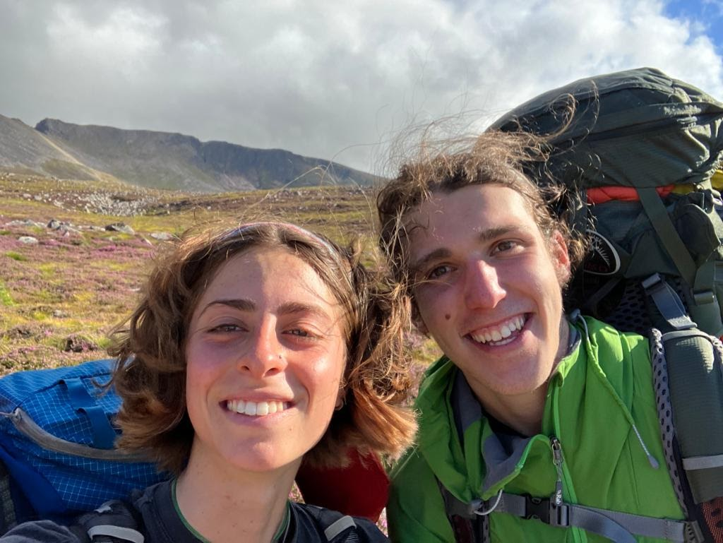
The winter season so far this year has been sub-optimal. After a promising and cold start, we’ve been plagued with high winds, warm temperatures, and bugger-all snow. Sub-optimal connies for sending!
Last week – there was a break: low temperatures, low winds, good vis? Uni work was to be cast aside – and the M90 bus to be taken to Aviemore to sample some of Scotland’s finest winter climbing.
Opting to avoid the extortionate cost of youth hostels, campsites, and hotels, we set up our tent in a bush in a secluded corner of Aviemore, just above the A9. Despite the pine forest, we were pitched in, the road noise somewhat damped the ambience of the forest. After watching a movie, we set our alarms early and went to bed.
The next day, alarms blared us into action. Neither one of us had a car, so we snuck into the youth hostel and began asking guests for a lift. After being turned down by a couple of folks, two hillwalkers from the South East agreed to give us a lift to the ski centre – a great success.
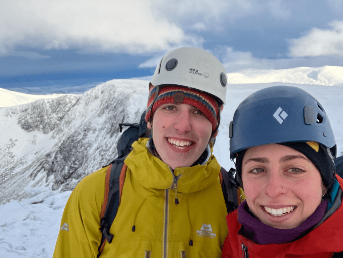
Upon arriving at the ski centre, we were pleased to see there was excellent visibility and blue skies. Ideal.
The snow cover was pretty minimal, making for a quick walk-in. Corrie an Snechda was busy, full of excited climbers and skills groups.
We scoped out our route ahead – a few parties were already on it. After gearing up, we began climbing the straightforward approach slopes.
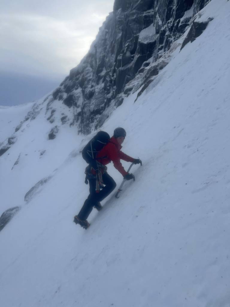
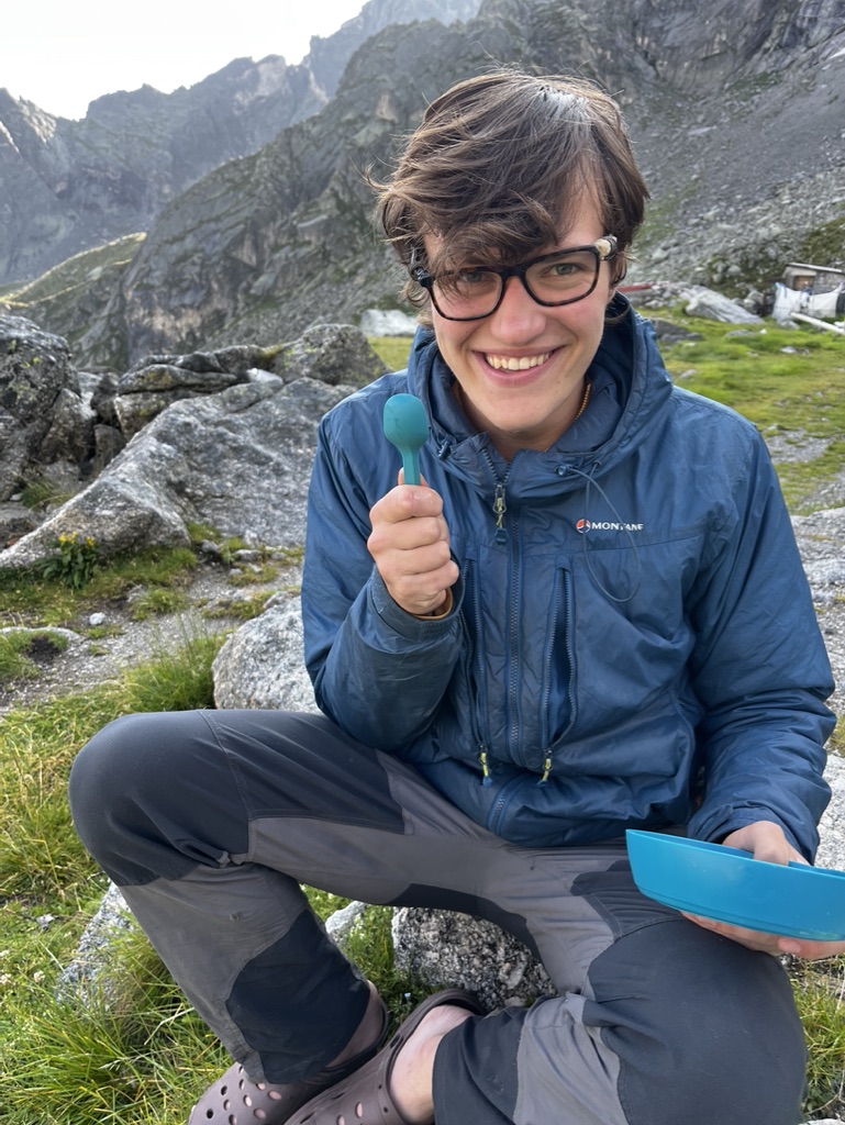
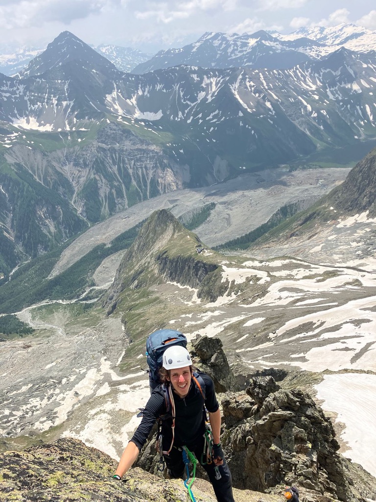
Lara enjoying the excellent snow conditions
The refrozen snow was lovely to climb: easy and secure first time placements enabled swift progress.
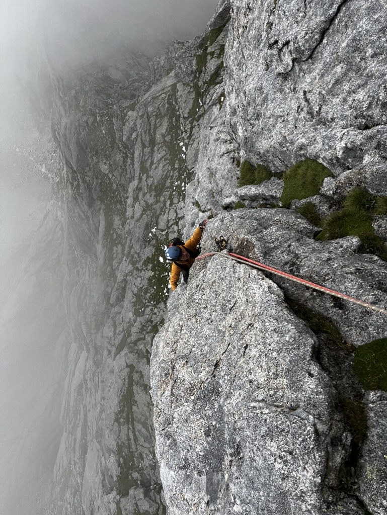
We established a belay at the base of the route, and I led the first pitch: an easy but enjoyable snowy ramp leading two more intricate steps. Although the snow was helpful today, the ice was not. A thin layer, about half an inch thick, covered the rocks and was extremely brittle: meaning it was difficult to find secure axe placements and cracks were too icey to allow for good protection. Nevertheless, there was gear out to the side, and the climbing was relatively straightforward.
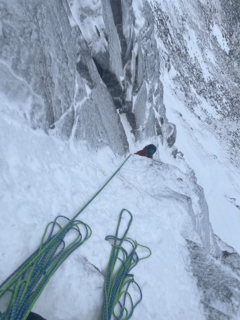
Looking down the first pitch
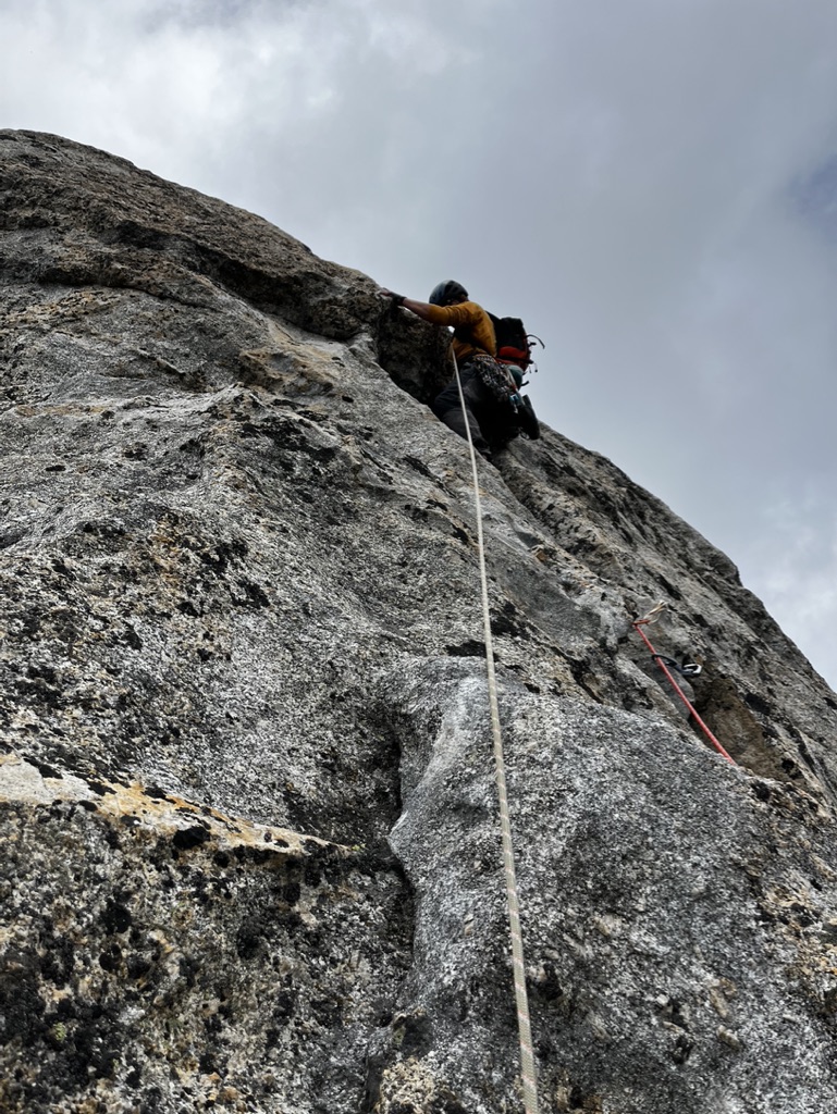
Lara took the next pitch – a fiddly little pitch with a couple of difficult steps – a little further from gear than you’d like. The climbing was delightful – involving overcoming two steep bulges.
The third pitch was my highlight: a snow ramp leading to a technical corner with good gear and an exciting finale: a short overhanging wall. A short, technical bridging section overcame this before reaching up for some good hooks over the bulge. Then, I walked my feet up the wall to good ledges and established a belay just above the bulge. This was the highlight of the route for me, and I couldn’t stop smiling at the quality of the climbing.
The next pitch was very different in character—a short groove led to a traverse and then another groove to the top. Lara made short work of this – despite the gear not always being great—a very good lead.
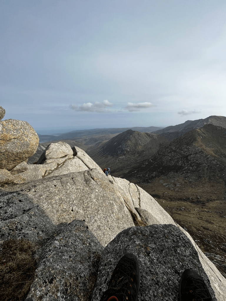
Views across the plateau
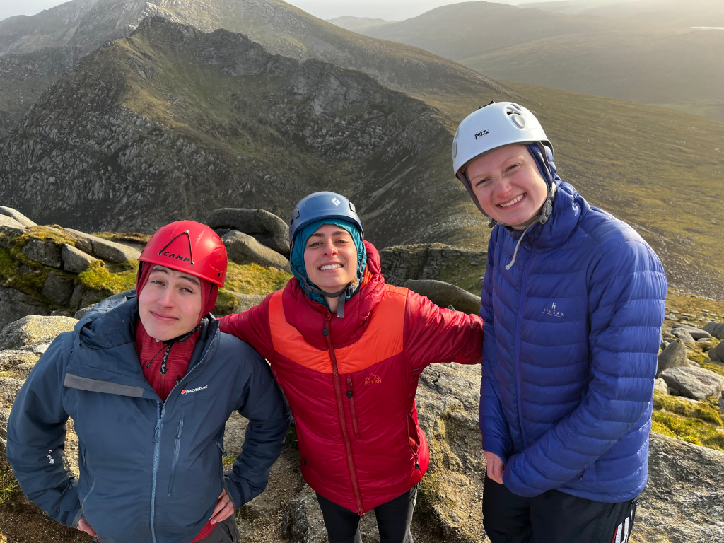
We topped out into the sun. It had been a brilliant day, and as we walked round the top of Snechda to 1141, we had beautiful views across to Shelterstone and across to Beinn a Bhurd and Ben Avon. What a day!
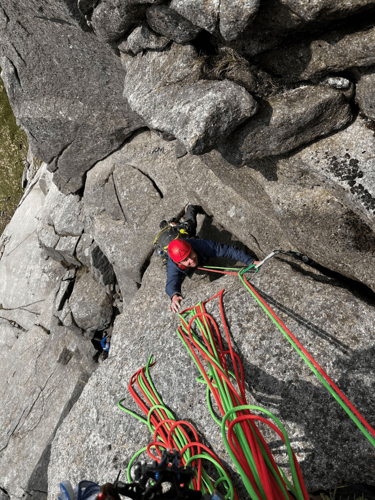
When I first saw South Ridge direct in the guidebook, I was awestruck. A 400m VS up this perfect granite crest of rock? What could be better.
Lara, Meg, Fergus, and I were camped in Glen Rosa. After a fun evening avoiding midges, we set off in the morning to attempt this beautiful route. I was to climb with Fergus. This was his first mountain multipitch. How exciting!
I suggested I lead the inital block of pitches, till after the Y-Cracks, so he could get a feel for the rock and see if he wanted to lead any of the easier top pitches. Fergus was happy with this plan, so we set off.
I scampered up the first pitches. I was carrying a double rack of cams, which whilst not at all necessary, made the climbing far quicker. Rather than spending time fiddling wires into nearly parallel cracks, I could just wam a cam in and keep climbing – ideal!
The initial pitches are straightforward. The climbing isn’t harder than S/HS, and the gear, although spaced, is good. Rapidly, we were at the base of the S Cracks pitch, with Lara and Meg right behind us.
The S-Cracks pitch is the first ‘crux’ pitch of the route: a 30m S-shaped crack in perfect granite. The gear is good, and the climbing wonderful and flowy. This pitched exemplified the importance of confident footwork on granite: there were no edges to place your feet onto, but the friction of the rock combined with the slabby nature of the climbing meant you could completely trust even the smallest of crystals. Wonderful!
Fergus followed with ease, and we were soon at the base of the infamous Y-Cracks. I must admit it looked rather brutal: a slightly overhanging wall with an improbable looking mantleshelf? What joy!
I psyched myself up and climbed to the buldge, arranged gear, and commited. Throwing my arm deep into the crack, I desperately jammed as I threw my heal above my head onto the ledge above. Rocking over, I reached towards a jug shaped hold. Alas, it was not a jug, but it was a rather positive sloper. This enabled me to complete the mantleshelf in a somewhat composed manner. I built a belay and began bringing Fergus up.
“Oscar – watch me here!”
He commited fully to lunging to the jug, and just scraped it with his fingers.
Immitating Dave Macloed on Hold Fast Hold True, he screamed “SHIT” as his fingers uncurled and he slumped on to the rope. What a brilliant effort! Not easy to commit that much in such an exposed position!
He tried again, and this time, stuck the move. Fantastic! The difficulties were done, and wraps were required.
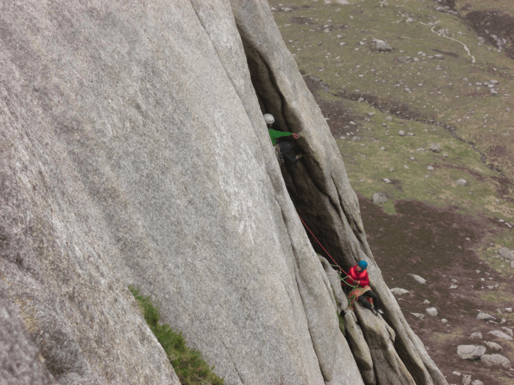
Lara above the infamous Y-Cracks pitch
The next section of the ridge is basically walking, and would be easier to simul-climb as the blocky nature makes it a right pain in the arse to pitch it out. The gear is a little spaced, so if you chose to simul climb, I’d aim to have 15-20m between the climbers to ensure you can arrange enough gear to protect this section (no harder than Diff-Vdiff, but very exposed). This arrives you at the base of this wonderful flake, the final VS pitch of the route.
You follow the corner crack up to a juggy band of granitic mushrooms, before making a bold traverse along these to reach a large ledge, where this route joins Sou’wester slabs. You can also carry on up the corner at tech 5c.
Fergus crusing along on the upper pitches of South Ridge Direct
Here, the climbing remains fantastic, but becomes far more traditional. A blocky chimney leads to a thin ridge crest, then to another large ledge where you have an opportunity to walk off the ridge if needed. As we were making excellent time, we quested on up to the very top of the ridge. The climbing here is fantastic: an unexpectedly easy pull through an overhang leads to a chimney were we belayed. From here, simple slab padding and a cheeky mantle leads to a spectacular granite crest.
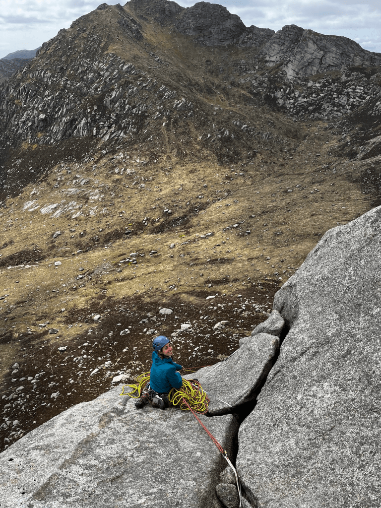
With buckets of exposure, perfect views, and superb rock, this last pitch was brilliant! We sat atop the ridge, waiting for Lara and Meg who’d got caught behind a slower party. It was here Fergus introduced me to the joys of “T’ Tobasco, Chorizo, and Cheese wraps”. We spent a couple of hours enjoying the sun and chatting utter shit until finally Lara pulled over the ridge crest just as the sun was beginning to produce a wonderful golden light. What a wonderful day!
Lara topping out
After a restful night, the plan for the next day was for Lara and I to tackle West Flank Route, and Meg and Fergus to take on Sou’wester slabs. After a slightly grim walk in, Lara geared up for the initial chimney pitch.
This was not a nice bit of climbing…
Water runs down the far side of the chimney, meaning the rock was lichenous and scrittly, and the crack flared significantly, making it difficult to protect. Lara battled her way up this utterly desperate pitch in an inspired lead (Tech 5a my arse!).
I got to the next belay, and stared up at the next chimney in dread. At least this one looked safe…
I grunted and cried my way up it. Periodically swearing, screaming about how much I hate climbing. It was strange to feel simultaneously stuck and like I was falling – genuinely an awful pitch.
The desperate chimney pitch
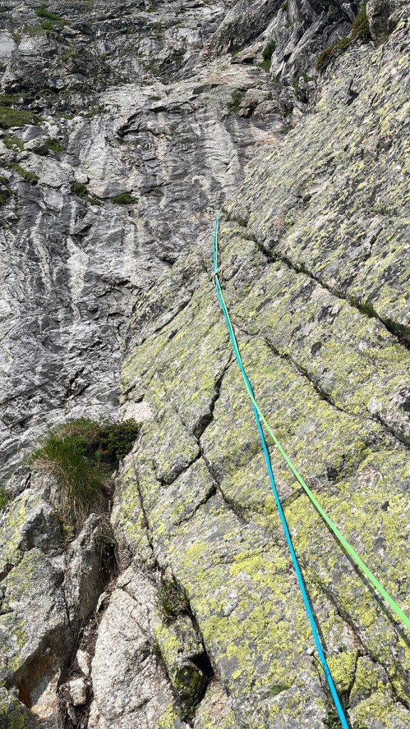
The next pitch was utterly brilliant. A 35m diagonal crack. The climbing was straightforward, but the crack was shalow and sloping, meaning the opportunities for protection were scarce: I only managed to arrange a few tipped out small cams over the course of the entire pitch. Have faith in the friction, and you’ll be fine.
Next, there is the supposed crux pitch, a wonderful corner leading to a small traverse. The climbing here is simply joyus, and to me is amongst the finest pitches of climbing in this country. The line is obvious, a wonderful corner crack, near perfect hands the whole way with perfect gear. The rock is clean, immpecably solid, and a complete and utter joy to climb. I did scupper my rope management before the traverse a little bit which made it all a bit draggy, but still I reveled in the quality of this climbing.
From here, you interesect with Sou’Wester slabs, where I briefly chatted to Meg and Fergus, before surveying the rest of the route. The next pitch was a wonderful pitch at around VS traversing below a massive overlap. The climbing was wonderful, but covered in spiders. Given my crippling fear of these bastards, it was frankly a terrifying. I was glad the gear was good: I knew if one got too close I could jump off, hopefully avoding the wrath of these little monsters.
Two pitches of easy cracks (around VS) lead to terrace, where the route finishes and you walk off. I was absolutely freezing at this point: we’d only taken one belay jacket between us and Lara had been wearing it, so I swiftly put on both our waterproofs and all our other spare clothes and we walked down.
On the descent, we stopped and waited for Meg and Fergus. As we waited, we looked at the route we’d just climbed: each pitch was such an obvious and inspiring feature, especially the 35m diagonal crack. To me, this route stands out as the finest route I’ve climbed in Scotland, better than The Needle, the Pale Didre, and indeed, it’s more famous neighbor, South Ridge Direct. The combination of perfect granite, fantastic climbing, and an inspiring line makes it somewhat unbeatable in my eyes. The initial chimney pitches were utterly desperate, but somehow add to the route: the crux pitch to me barely warrents E1 (good gear, easy climbing), so without a bit of a desperate struggle, one would feel some what short-changed.
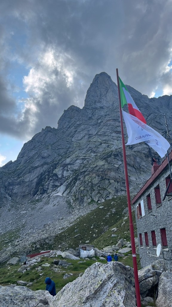
Arran is certainly one of the best places to climb in the UK. The quality of the rock is comparable to the very best Alpine Granite, and the views and wild feel of the island itself surely make it one of the best climbing destinations in the UK.
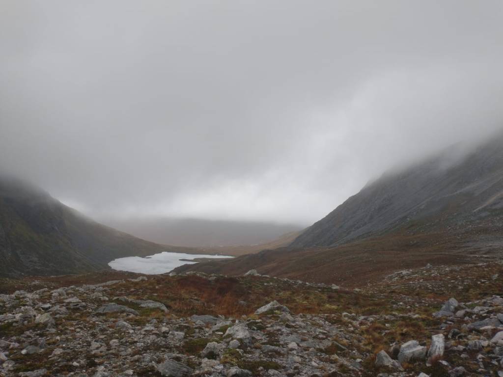
The Cairngorms are a vast plateau, with big corries surrounded by steep walls of granite. These cliffs, dark, gloomy, and North facing, are a paradise for climbers. The scale and remoteness of the cliffs offer a level of commitment matched by only a handful of crags in the UK.
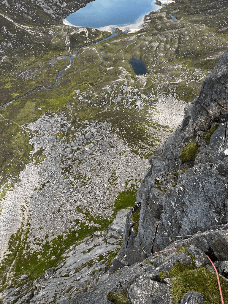
Certainly in the Northern Cairngorms, one of the greatest routes is the Needle. Campbell’s eye for route finding was quite special. The Shelterstone cliff had been for years deemed impenetrable, with only a small, and rarely repeated VS working its way up the edge of it. Campbell did no such thing. Starting directly below a great split in the skyline, he initially aimed straight for the notch. The two initial pitches are straight up. Towards the central parts of the face, Campbell found a series of connecting pitches which allowed passage through an otherwise impenetrable section of rock. Eventually, you’re reach the mighty needle crack, a 40m off-width crack on wonderful rock. As you fling yourself over the lip in a sorry mixture of relief and disappointment that the spectacular grovel is over, you realise only one pitch bars you from the summit. An easy scramble, into a tight squeeze. Then, once you have lost all dignity squeezing through the soggy eye of the needle, you are reborn through a whole in the ground in the plateau.
The needle had been on our to do list for a while, and when we saw a weather window, we jumped at the opportunity. We forged a plan, we’d go up for 2 days, camp high on the Plateau, and spend one day climbing on Corrie Sputan Derag, and the next day attempt the needle.
Being accustomed to the warmth and comfort of alpine huts, the cold came as a shock. We pitched the tent (luckily we’d opted for the 4 season model), and threw ourselves inside.
“I’m fucking starving, let’s get dinner on” I said
Lara agreed. We set up the stove, I’d just bought a set of new pots. Exciting!
“Pass me the lighter Oscar” Lara said.
“Erm….”
I patted my pockets frantically – surely I didn’t forget a lighter.
“Maybe you have one?”
Lara searched her bags, but we both knew that we would once again be enjoying an uncooked dinner.
I had tortellini, which made for a surprisingly pleasant meal uncooked. Lara had instant noodles, which were far worse. We lacked the patience to soak them properly, so she added her sauce and crunched away. Pretty grim!
We awoke the next day – hungry. We had some overnight oats, which although pleasant, aren’t what you want when it’s only just above zero! We hoped to flag down a hiker on the walk over to Corrie Sputan Derag, and beg, borrow, or even steal some matches.
We walked over Ben Macdui, and as we descended down towards Loch Etchecan, we saw a hiker with a wonderful dog.
This hiker, Ray, was one of the loveliest people I’ve ever met in the hills. He gave us some matches, despite then being hurried at the bottom of our bag, and told us about him. He’s spent 20 years working in Mountain Rescue down in the Peaks, but worked as a lecturer at Sheffield uni as a day job. His dog was about to do their first Munro! He wished us well, and we both were left glowing at what a genuinely lovely bloke we’d just met. Happy days!!
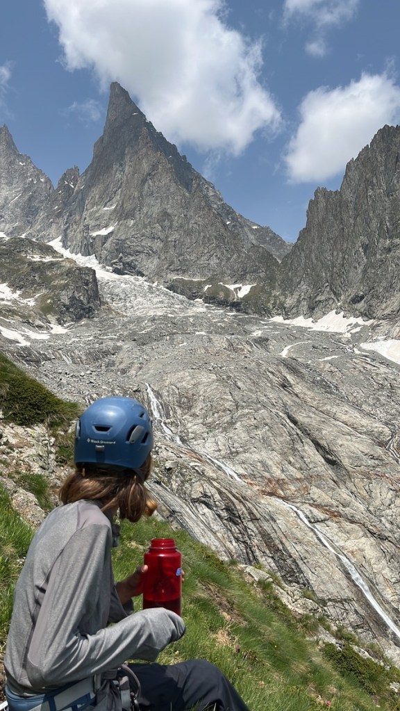
Now, onto the climbing. The first route was Ametheyst Pillar, a 3* HVS. The first pitch was my first trad climb in the UK in a couple of months, and it was a bit of a reminder of how fiddly uk trad can be. There was no worthwhile gear for 10 or so m, then the rest of the pitch had plenty, but it was all a pain in the arse to place. The second pitch was an enjoyable series of flakes, well protected to a large ledge. The final pitch looked desperate from below, a pull through a bulge with overhead gear proved to be an interesting crux, then quickly you gain an enjoyable hand crack which plops you out onto the plateau. A highly enjoyable route.
Next, we set out sights to the other classic of the crag: grey slab. The climbing on this route was good, if not excessively memorable. The corner was wet and greasy which definitely took away from the experience, but the positions were highly enjoyable. I thought the route was quite difficult for HS, and an easy VS would have been more fair.
We topped out and walked back to the tents. I began to have my usual evening freak out. I expressed my doubts to Lara, who as ever was sympathetic but encouraging that we’d be fine (and she was of course, right!) I doubted that the rock would be dry, and that we’d be fast enough to get the route done in a reasonable amount of time. We put a message in a yummick group chat and we’re advised that it goes in the damp…I guess we would have to give it beans tomorrow and see how it turned out.
We awoke early, and we’re disappointed by how dewy of a night it was. The ground was sopping. Surely the route would be wet…
Despite our doubts, we walked across the plateau in beautiful morning light. The crag was glistening: not a good sign. I was convinced we should go elsewhere : Crimson Slabs would be dry, and we’d surely get a day of climbing in there. Lara, was determined it was worth a shot, so we pressed on.
We reached the base of the route – it looked pretty much dry except for the upper reaches. Given the only bold pitch was the second (and luckily that was Lara’s lead), we agreed that we would be able to make progress on the damp upper reaches of the crag. We each had a few grades in hand, and the opportunity was too good to miss.
The initial pitch was rambling and straightforward to a good ledge. Many people reported finding this bold – I didn’t think it was spaced but bomber gear was all around, and honestly the climbing was sufficiently straightforward that very little was required.
I built a belay, weary not to use any kit that could be useful on the crux pitch. Lara arrived and racked up, staring up at the headwall above. After consulting the topo she set off, enjoying the climbing, which looked bold and hard. As Lara quested on up, we were both getting attacked my a swarm of midges. I desperately wrapped Lara’s jacket around my ankles in an attempt to shield them from the hordes, it did not work. I can only imagine how unpleasant it would have been for Lara: contemplating poorly protected 5b moves whilst getting attacked by the wee beasties. She arrived at the belay after an utterly superb lead.
I followed as quickly as I could. The climbing was difficult, not loads of gear and lots of top end 5a low end 5b moves which had gear well below your feet. South of the border, I feel this pitch would have gotten E2.
Then, it was my block of leads. The next pitch was a straightforward VS romp to reach the base of the second crux pitch. Crucially, this belay was no longer getting midged. Great success!
The second 5b pitch was pretty straightforward. A crack with good gear led to an awkward ledge shuffle. Then you arrange a few pieces, and pull through a minor bulge. Although perhaps marginally more physically taxing than the crux of the second pitch, the gear is bomber and at waist level, and it’s over very quickly. Before you know it, you’re at the belay. It felt reminiscent of the crux moves of Salluard route on Pointe Aldolphene Rey, only better protected, easier and not at altitude!
Lara took over here, leading to the base of the crack for thin fingers. A lot of people we know have gotten a wee bit lost on this pitch, but you can actually see the crack for thin fingers (and the massive ledge just below it) from the belay. Lara dispatched this quickly and skilfully, and we agreed to have a wee lunch break here.
Sandwiches eaten, Lara pondered the crack for thin fingers. It looked desperate! Arranging some gear (thank you black totem!), she lay backed the crack before lunging for the sloping ledges above the famous lose ‘thank god jug’ that tempts all climbers. The rest of the pitch is a straightforward romp. You can see the fantastic looking corner pitches of the steeple to your left: these look frankly brilliant, Steeple must be done next season!
Then, it was my block of leads. A simple VS approach pitch led to the base of needle crack which was sopping wet. It had to be done…
Wedging my arse into the crack, I thrutched and grovelled my way up the pitch. The gear was good, and the climbing excellent and engaging. It was a good mix of technical bridging (less enjoyable in the wet), and desperate thrutching (is this ever enjoyable?). 30m later – I stood atop needle crack. I brought Lara up, and as she set off on the final scramble, I pondered the view across Loch Avon.
The Cairngorms is a deeply special place to me – so many of my formative mountain moments have been had on these monolithic peaks. I remember years ago in London discussing this mountains with my Dad, in an almost a revered tone. The idea of being on the Cairngorm Plateau even just a hillwalker was somewhat terrifying. The first time I visited I skipped off school and we drove up from London. We spent two nights wild camping and bagging the Munros around the Northern Cairngorms. It was a life changing trip – never had I experienced mountains so big and wild. I was in awe. My Dad especially loved the Cairngorms…he’d always update me with Chris Townsend’s condition report before I went to school, and would revel in any book written about this range. Climbing this route almost exactly one year after he died was very special to me in a way that isn’t particularly easy to put in to words.
“On Belay Oscar!”
I scrambled up the easy ground, and grovelled through the tight chimney at the top (the eye of the needle!). I greeted Lara with a hug. It had been one of the routes we’d both been desperate to do – but it felt so unachievable. Not only had we done it – but it hadn’t even been an epic. Just a genuinely brilliant day out, and a really ace trip.
‘Right Charlie, the route looks pretty steady, mostly about HS, good pegs on the belays, obvious route finding, simple descent – an ideal first alpine route for Chodd’.
How wrong I was. Turns out, the Italians love a good sandbag – or perhaps have no real grasp of grades at all? Everything about this route turned out to be pretty unexpected – and that’s why it was an absolutely cracking adventure.
The day started early. We looked outside – the rock was dry. After last night’s rain, this was a nice surprise, and we left the hut in high spirits. I hadn’t seen Charlie for a month, and had missed him. It was lovely to chat to him again!
As we reached the system of ledges that led to the start of the route – we roped up, hoping to be able to use spikes to safeguard ourselves as we scrambled along the loose terrain. This proved to be a poor decision. There were not enough spikes, or gear, to provide ourselves with a reasonable degree of security, and it only added faff and risk. The approach was not particularly easy: the topo in the Solo Granito guide was quite rubbish, and the route finding not particularly intuitive. Eventually, we reached the start of the route. We accidentally simul-climbed half the first pitch, not realising the route had started proper, quickly set up a belay around a big spike, and continued to the first proper belay- two pegs.
Here – the guidebook description simply said – follow the right hand crack. There was a right hand crack above: but it looked utterly desperate. A steep overhanging finger crack led to a blank wall above. This pitch was meant to be 5b? The ground above looked about 6c, and poorly protected. Doubts started arising. Charlie just about had signal on his phone, so we googled the route trying to find a better description and topo.
We managed to find a brilliant website (sassobloss), which had a far better description.
‘climb the slab on the right (piton visible) and with a subsequent traverse to the right go under the vertical of a dihedral; go up it and at its end move left entering a small niche where the belay is located (3 pegs+cord+quick link).’
We looked to our right – the obvious ramp feature made much more sense at the grade. I set off again, eventually finding a piton. Questing on, I found myself below a small bulge. Now, I took the right hand crack. Although not desperate, this pitch was not easy either and felt like a pretty solid HVS pitch. The gear was not the most confidence inspiring in the world, and the moves were strenuous, especially with a backpack on. I reached the belay, somewhat glad. Surely it can only get easier from here?
Charlie valiantly led the next pitch, a bold traverse, involving clipping a very wobbly piton and making easy, but exposed moves along a foot ledge. An ‘Of course it’s good enough’ mentality was required to get through this bit smoothly.
I then led the next pitch, a corner, leading to a roof. I went straight through the roof, but the route is meant to go to the left of it. It was here I scuppered myself. I saw a piton high in the hanging groove above and began questing to it. Eventually, the run out became too large, and the rope drag too much. I built a belay with some difficulty as there was little gear. I looked to my right, and exactly level with me, 10m to my right, was a belay built on pegs (old and rusted of course!), and a much more obvious line. Fuck!
I brought Charlie up and sheepishly suggested that I lower him off to the splitting of the crack, and he climbs the correct crack until he is level with me before placing a runner to protect the hard section through the bulge (which was ABSOLUTELY desperate and a cheeky cam pull was deployed. Bonjour!). The blog described this pitch as having 13 pitons. As Charlie quested on, he found none. I was getting anxious at this point – this was not the place to get lost! He boldly led on…
I kept paying out slack, with growing anxiety as went out of ear shot, and began to have very little rope left.
“Oi, Banford, no rope left”
Nothing….
“Charlie mate ur nearly out of rope!”
He still carried on….
The rope ran out. I’d heard no shout of ‘safe’, and nothing to indicate he was. I trusted Charlie, and knew he’d work something out, but it was a stressful few minutes as I waited to hear his shout from above.
Eventually, I heard something from above accompanied by the familiar tug of Charlie tying his clove hitch – surely that was him? Well, it better be. I took him off belay and felt the ropes pull tight on me? Was I on belay? Or was I about to commit to a rather difficult traverse with Charlie still climbing?
I deconstructed the belay and took a deep breath, I felt the ropes pull in such a way that made me nearly certain I was on belay, and took a deep breath. With hundreds of metres of air beneath my feet, I had to traverse the thin slab as there was not enough rope to lower me to the easy crack. I persuaded the rubber on my shoes to stick to the granite, and began the traverse.
After some tedious moves, I reached the other crack system and began questing up the wet, thrutchy grove. After pulling through an overhang, I heard Charlie’s voice from above. We’d reach the ledge system. Two pitches to go. Happy days.
We worked out where we were on the topo. The guidebook had been laughably wrong (as was later confirmed by the hut guardian), and the climbing far harder and bolder than we anticipated. Charlie had linked two pitches to form a 60m mega pitch.
The next pitch was easy, then, there was the supposed crux. A beautiful slab with a thin crack running up it. This was actually incredibly straightforward and on good rock, unlike the rest of the route.
We reached the summit relieved. What an adventure. The descent was supposedly straightforward. The guidebook described three 60m abseils. That was it. Should be quick and easy….
Three abseils later, I found myself, at the end of my rope, with no ground in sight. I was rather pissed off at this bloody guidebook at this point. I prussiked up the rope, and began a pendulum traverse to reach rocky spur, which I thought might hold the key to reaching the hut (and Ritter!). Upon reaching the spur, I was briefly confused, but there wasn’t really another option, so I told Charlie to follow, whilst desperately searching for a way down.
I realised we could ab down to a system of ledges that we could follow round to the approach, but this would mean leaving kit behind, and deal with a loose, chossy, and frankly somewhat dangerous gully which we downclimbed earlier in the day. Suboptimal…
I continued searching, eventually spotting a cairn. Once the ropes were pulled, we set off towards this lonely cairn. The thing with these so called ‘little men’ is that they are not particularly well maintained on these routes, and upon reaching this cairn, we could see no others. For fucks sake! Bloody guidebook!
We searched around, eventually finding two bolts above a large slab. Happy days! There are few things I enjoy as much as abseiling, especially when you don’t know quite where you’ll end up.
I could see the approach ledges below us…surely this would get us there…
I set off, slowly letting the rope run through my hands. 30m done…still no belay. 40m done….still no belay. 50m done…over a vertical wall. The ends of the rope…a small ledge, but no belay. I looked down and around – I was just 10m above the approach ledges, and the terrain was easy enough to dowmclimb. I grasped on the rocks and took myself off abseil.
‘Rope Free!’
Charlie set off, following me down. It must’ve come as quite a shock to make an abseil only to find me essentially soloing above the approach ledges.
We pulled the ropes, and easily down climbed the approach ledges. Only a short walk was between me and that wonderful bar of Ritter.
What a day! Turns out Val di Zocca loves a bit of sandbagging, and the guidebook author likes to drink a bit too much moretti! It was validating to have the hut guardian point to the guidebook, laugh, and say ‘No good!, did you find the way ok?’.
The Monzino hut is the base used for many of the hard, classic routes up Mont Blanc. From here, you can see the imposing red rock of the Broulliard Pillars, the endless gendarmes of the Peturay Integrale ridge and the remote, and terrifying Freny Pillars. Then there is the Aguille Croux. Although much smaller in stature than its neighbours, the sharp triangular shape, and steep, South Easterly face mirrors the form of the Aguille Noire du Peturay. For smaller adventures, for novice alpinists like ourselves, it is a brilliant playground. You can enjoy a fantastic adventure in its own right, and whilst you’re climbing, you can stare at the great alpine test pieces that surround you, and dream of bigger adventures to come.
The Ottoz Hurzler is the most famous route on the face. To the summit, it’s 400m or so of brilliant granite. Following a weaving line up the face, tackling the easiest groves and chimneys available, the route has a highly adventurous feel. The line is not obvious from afar, but feels wonderfully organic and intuitive once on route. Naturally, this made it the obvious target for us.
We began our adventure by taking the bus to the end of Val Veny. Being climbers, the thought of a hill walk was frankly revolting. Surely, doing Velociraptor, a 400m sport route with bivvy kit in the packs (the Monzino hut was too expensive for our limited student budget) seemed like a sensible way to go about things. We got to the base of the route, and quickly, we realised how bloody hard it is to climb with such heavy bags.
Normally, when climbing on easier terrain, I find it faster and more secure to get high feet and do large foot movements between secure and larger footholds, however, this is not the way to go about things with such a heavy back. We had to adjust to doing much smaller motions with our feet, relying on small granite nubbins to support our weight. Not so confidence inspiring when you’re used to slippery Scottish schist! The granite here however proved to be remarkably grippy, and it was superbly satisfying to be able to use such small footholds.
The route itself was highly enjoyable, weaving a curious line up the wall. The only thing that let it down was its ledgey nature, meaning the positions were a little disappointing.
After this we reached the Monzino hut, rather knackered. The lifts of chamonix had made us soft to the brutal nature of walk ins in the alps. Luckily, cake was available to ease our pain, and we spent several hours in the rifugio, resting, recovering, and relaxing.
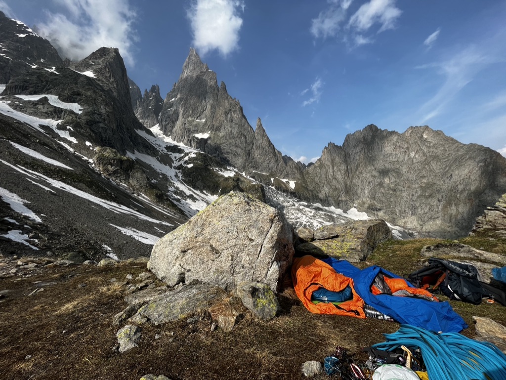
At 6pm the time came to find a bivvy spot. We found a boulder to tuck behind 5 minutes from the rifugio. Due to the extortionate cost of water, we started to melt snow. This was a waste of time. It took half an hour to melt a small amount of water, so we yielded to buying water from the hut, at an utterly extortionate cost. The sad thing was, for 300ml of dirty water, we’d used all of our gas, and as the stove began flickering before we’d even boiled the water for our tortellini. Desperately, we formed a shield around it, using lids, wrappers, and ourselves to eek out all the heat we can from our stove. The water began to boil. We scrambled to add the tortellini. The stove whimpered, coughed, and died, along with our dreams of a well cooked meal. Raw tortellini, and overnight oats it was for us.
The stunning views provided some consolation. I think as climbers we spend so much time in absolutely stunning places we forget to take them for granted. I often catch myself staring at my phone, oblivious to a stunning view. Tonight, at last, the view was too good to miss. To be surrounded by such grandeur: imposing towers and ridges, the red granite glowing in the setting sun, was the best view I’d ever seen, even if the haunting rumble of rockfall reminded us of the dangers is this environment.
The next morning we awoke early, had our oats, and set off. Quickly, the early season snow began to slow us down. The snow has rock hard, and although initially patchy, soon became continuous enough to warrant crampons. There was one section in particular section that was steep and icy, and required careful front pointing to pass through safely. Not as simple as we were hoping!
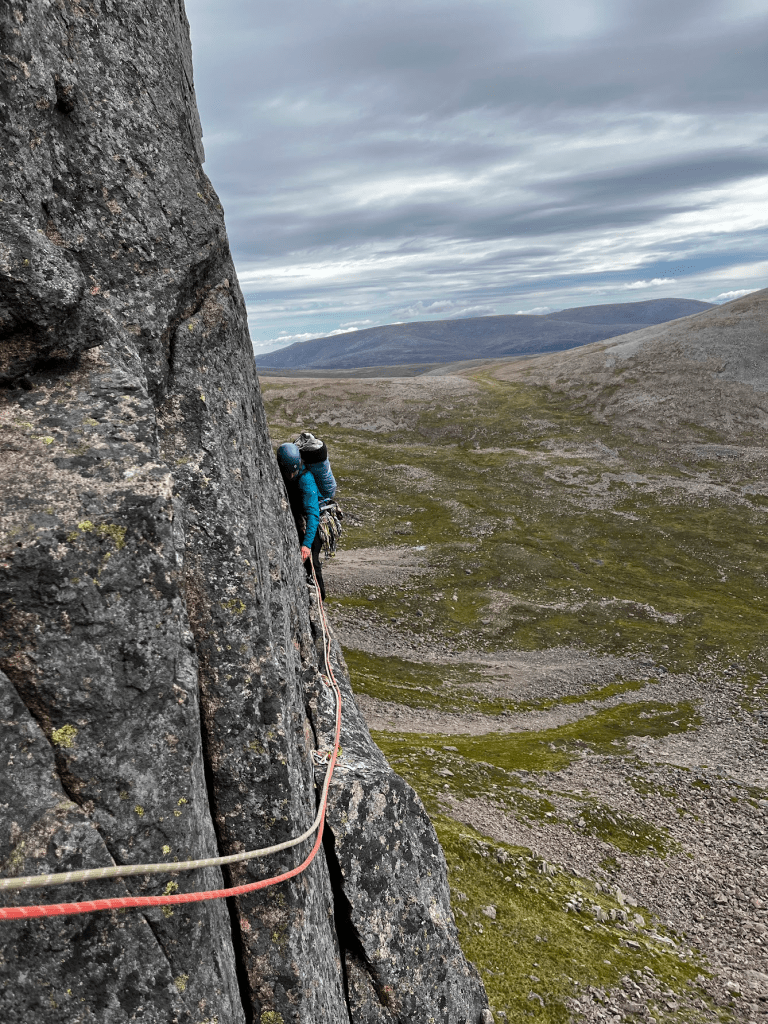
Eventually we arrived at the start of the route. The initial pitches are easy and rambling, taking in the easy angled, lower section of the wall. We dispatched these quickly, arriving at the base is the real climbing.
The first pitch of interest was a steep wall leading to a layback crack which was rather strenuous. Especially as we had employed a 1 bag between two strategy, Lara had to climb the pitch with both boots, crampons, and ice axes stuffed into my rucksack. Obviously, this made life rather difficult.
The traversing pitch(es) followed. Whilst technically just 1 pitch, it makes sense to split the pitch at the belay on Euroteam to avoid horrendous rope drag. The position on these pitches was superb; you climb just above a small overhang, aware of the hundreds of metres of exposure beneath your feet as you smear your feet against microscopic dimples in the granite. I led the second half of this traverse, and, upon reaching the belay, shouted that it was perhaps the finest pitch of climbing I’ve ever done? Superb positions, technical climbing, and an improbable looking like made it something quite special.
The next pitch is a simple chimney, a little strenuous, but never desperate. The climbing here is once again brilliant, and forces you to rely on your bridging to climb efficiently. The route had recently been rebolted, and perhaps a little excessively. Whilst the bolts make route finding far easier, this pitch would have been far more memorable had it been more in gear. I understand the need for a few bolts to show you the way, but surely placing bolts next to splitter cracks is superfluous?
There is one last pitch of interest on the route, the supposed crux. A steep wall, involving pulling in flakes in a superb position. A brilliant pitch. The bolts are close in this pitch, just a few m apart, so for me, this pitch felt very mellow.
Easy, but memorable climbing led to the summit ridge. Here, we met a euro-wad. An old man, perhaps sixty or seventy, climbing a pitch of about VS happily in mountaineering boots, humming away to himself, no gear in sight. Of course, for him, there was no need to place gear, because there was no chance of him falling off.
We reached the summit ridge, and upon seeing the time, opted to ab down rather than go to the summit. The final ridge had too much snow to climb without putting on boots and crampons and we were concerned about missing the last bus home. A series of well marked abs led down the face.
When I say well-marked, I mean well marked for anyone with some level of competence. I had an…exciting moment where I abed down too far to the left, missed the next ab station, and was forced to purissik up the rope for 30m. The terrain was low angled, so this wasn’t too bad, but as I moved up the rope, I knocked a few rocks onto myself and was forced to take evasive action. I reached the ab station, greeted by the old italian wad, somewhat stressed.
The Wad gave me a hand sorting everything out. He advised us that we could reach the snowfield from here with just one abseil. Thank god!
From the snowfield, there was just one more abseil to reach the glacier, and then the long trudge back to the car park. It was a trudge that never seemed to end. We reached the bottom of the via ferret section, and saw that there was a chance we could make the last bus. Woooo! We started jogging down hill, and just about made the bus.
Dinner, and of course, Ritter, tasted especially good that night. The route was one of the finest I’ve done in my life, and certainly stands out as one of the best of the trip. Yes, the rock quality on the Croux is not up to the standard of the granite on the triolet, but the setting is absolutely superb. The history that surrounds you, and the ‘big wall’ feel of the face is truly something special. I can not recommend this route highly enough.
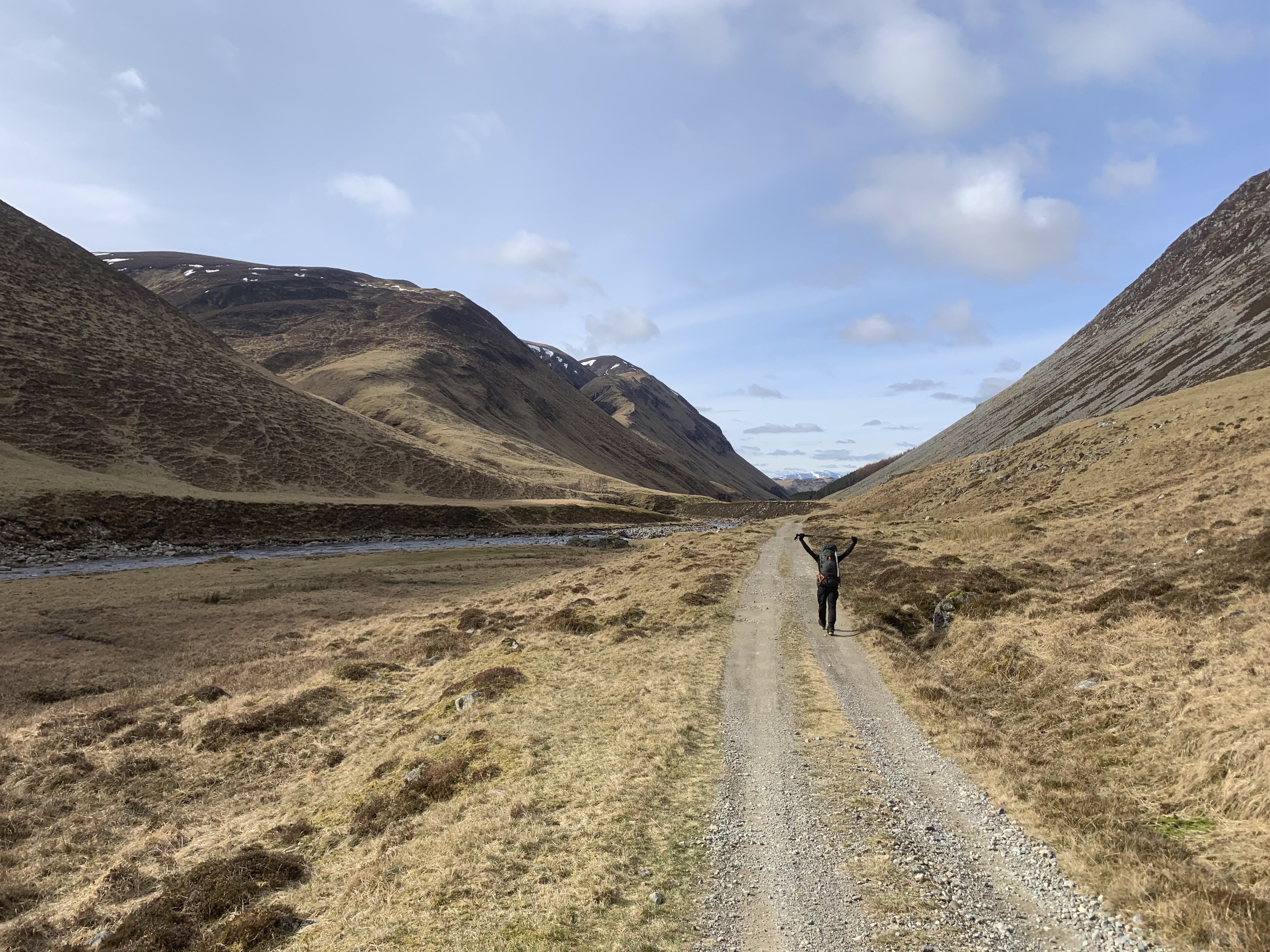
After a mediocre sleep on the Caledonian Sleeper, we stepped out of the train at Blair Atholl train station. Ahead of us – six days in the Scottish Highlands, aiming to bag Munros, stay in bothies, and explore some of the more remote areas in Scotland. The first two days would take us into the Southern Cairngorms, a barren landscape with rounded and gentle tops, guarded by bog and heather, the later 4 to Ben Alder Forest.
Day 1
I was a little nervous about this day. It was a long one – longer than I’d done on an expedition before. I knew I was fit, but as usual, I was concerned that I wasn’t fit enough for the ordeal ahead. My backpack wasn’t light, and I was fatigued from a long and stressful term. Definitely not an ideal way to start such a long and arduous trip!
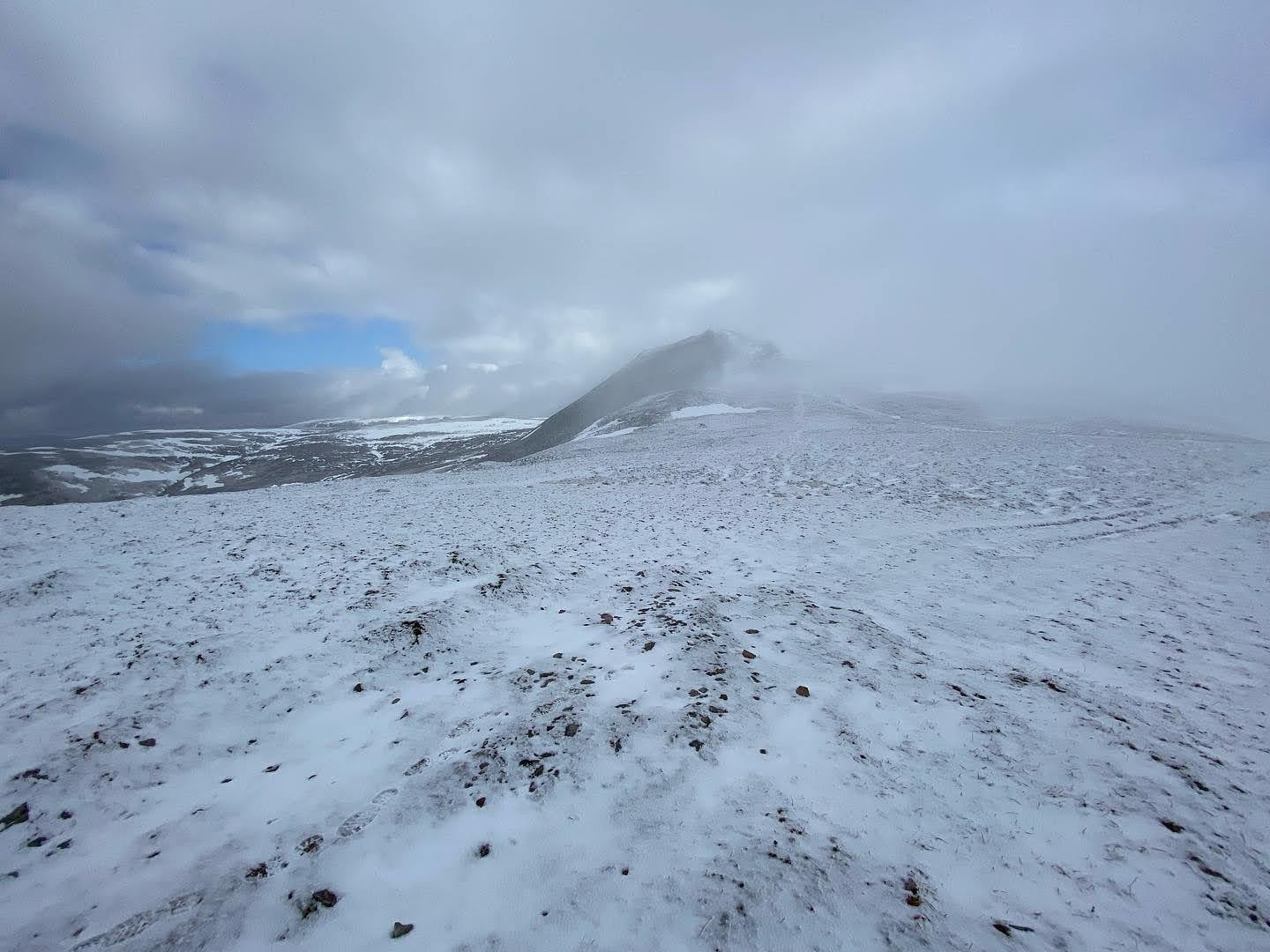
To begin with, we walked along a good track, then we turned off at NN 915 726 and began climbing on another 4×4 track, which gradually took us up to the summit of Carn a’ Chlamain, our first Munro of the trip. The hills had a cosmetic coat of snow, which I always adore. Sadly, as this was an expedition, my normal antics, to lie face down in every snow patch I see, had to be curtailed (this took a great deal of self-restraint!).
The descent to the Tarf Hotel bothy from here is quick and simple. The terrain permits reasonably rapid movement until the 800m mark, below which heather and bog hinder progress a little, but with a little common sense with route choice, progress remains quick.
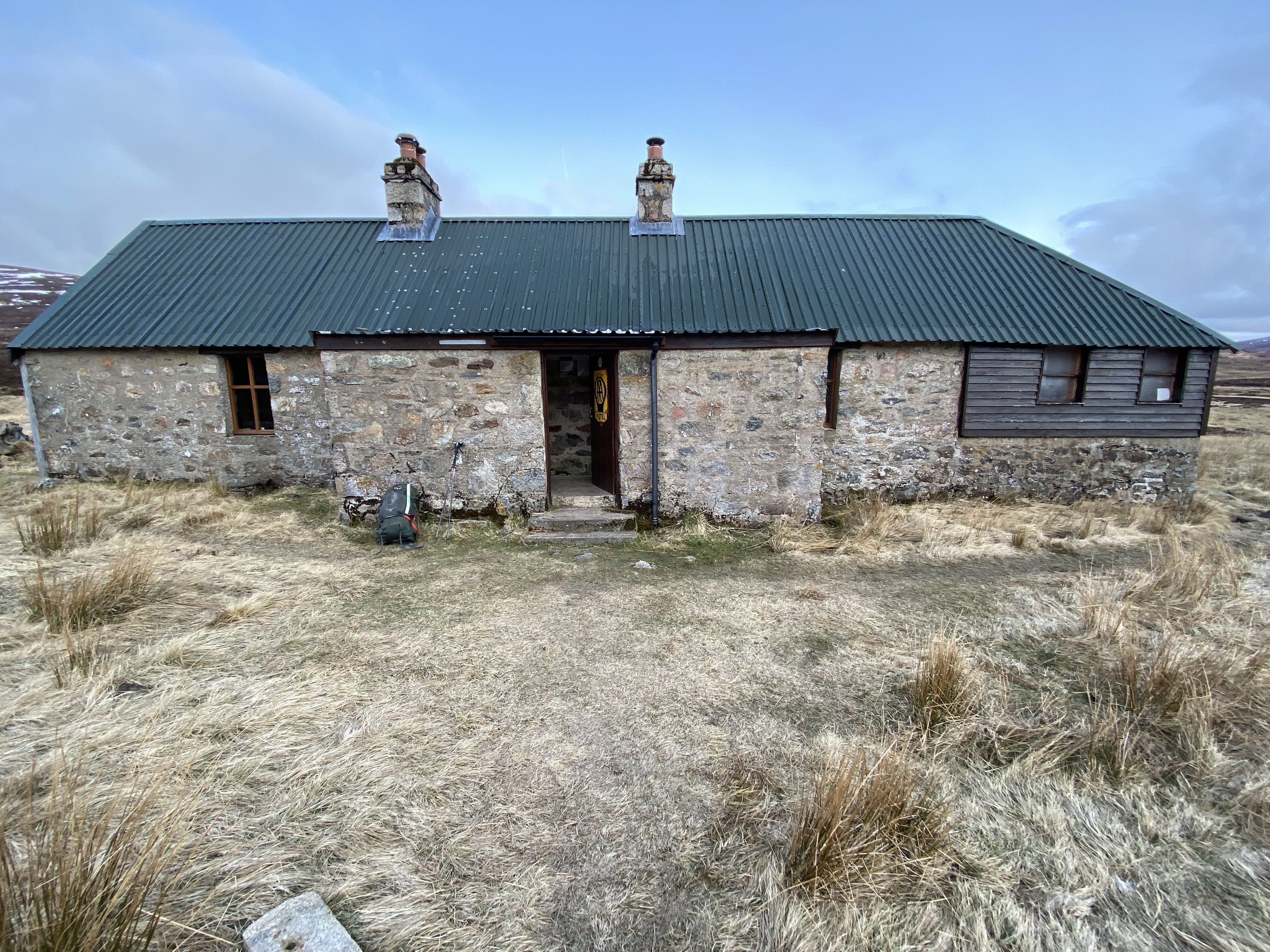
Upon arrival at the Tarf Hotel bothy, we had a brief lunch and ditched our tents and sleeping kit – we’d be returning here later in the day so didn’t need to carry them over the remaining two Munros of the day.
We began moving West along Tarf Water river to NN 903 805, where we followed the stream up to the saddle NN 912 817, although I’m doubtful this was the optimal route. Progress in the valley was slow and difficult, with heather, bog, and lingering snow sapping energy from my already knackered legs. I’d be curious to know if a direct ascent from NN 917 799, following the shoulder, would take you out of the boggy and heathery terrain faster, and allow for an easier passage. Whichever route you take, progress becomes much simpler once the broad shoulder is obtained, and progress towards the summit was made quickly, despite the sweltering heat.
Frustratingly, there is no way to avoid the 300m or so loss in altitude to reach the neighbouring Munro, An Sgarsoch. The ascent is reasonably hard going too – with bog and heather hindering any aspirations of rapid progress. Nevertheless, it is still reasonably short and the views from the slope are wonderful. Upon obtaining the summit, we were blessed with views across to the Northern Cairngorms, Ben Alder Forest, and Southern Highlands.
The descent to the Tarf Hotel Bothy from here is simple. The progress slows down as the gradient levels, and bogs and heather become much more problematic. We arrived at the bothy at 18:00, having been walking for nearly 12 hours. Needless to say, we slept well that night.
Day 2
I woke up pretty tired. I always find the second day of an expedition poses the greatest challenge; neither the body nor the mind has become accustomed to the strains that they will be placed under, nor have you acclimatised fully to slightly more primitive living arrangements. Luckily for us, today was slightly shorter.
It began with a reasonably fast trudge East along Tarf Water, before following the track going South-East from NN 957 797. We then followed the track to NN 956 762, where we began the hard, steady plod up to the saddle at NN 952 728, where we ditched the bags and moved across to summit Carn nan Gabhar. As we moved back to grab our bags, it started snowing and I hit the wall hard. I hadn’t eaten enough much all day and I suffered for it.
Tragically, the weather did not permit a lunch stop! We pushed on over Braigh Corie Churin Bhalgain, and then onto Carn Liath. At this point, we were both in a bad place. I was unable to get energy back into my legs due to my poor nutritional strategy, and my friend was suffering from a nasty sickness. It was a long walk into Blair Atholl, where we enjoyed Fish and Chips.
Day 3
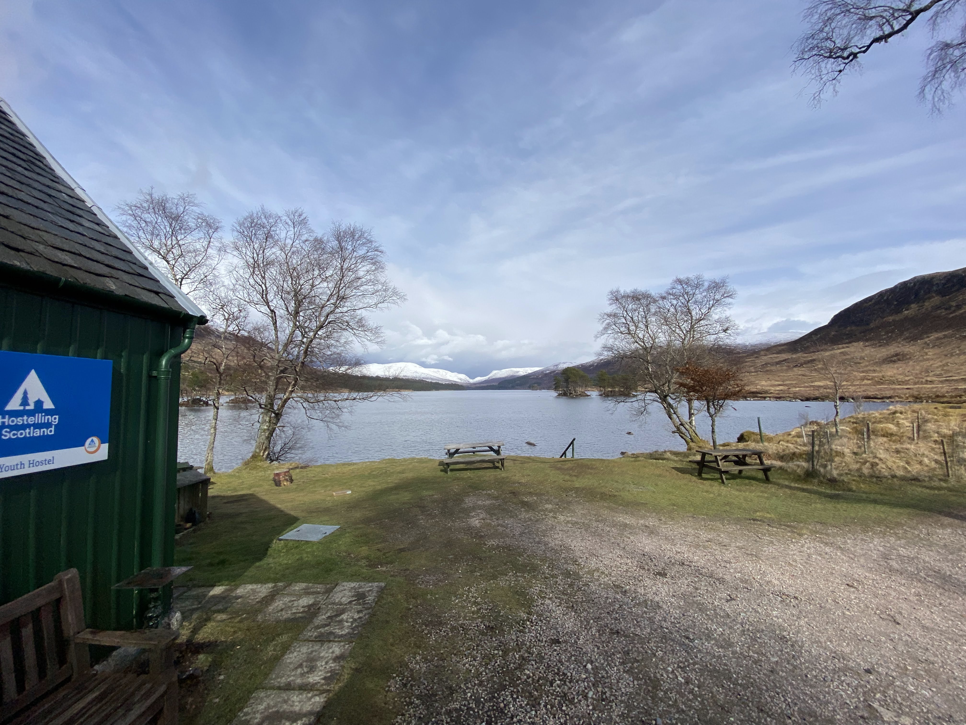
After this expedition, and with the weather looking far from ideal for the week ahead, we realised quickly that some replanning was called for. We opted to take the train to Corrourand stay in the YHA there for three nights, bagging the local Munros.
Day 4
My friend woke up feeling rough, leaving me with the prospect of a wee bit of solo Munro bagging. We agreed that the best option would be for me to head up Carn Derag and Sgor Gaibhre, a simple set of Munros that in total, would only mean walking 20km or so, and climbing 19km.
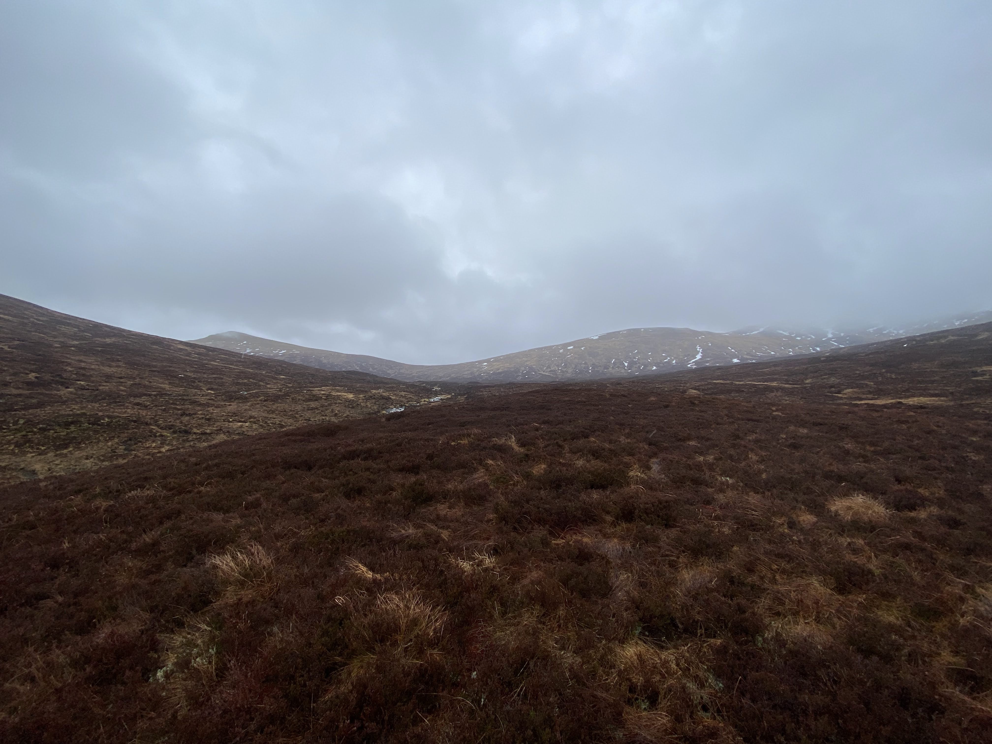
The weather was dreich. Far too wet to risk walking without a hardshell on, but far too sweaty if you have it on. Bloody nightmare! I met two madmen who had done a summit camp that night; it was cold and windy at hostel level, I dread to think about the kind of conditions they had to tolerate. Despite the weather, the summit of Carn Derag can be obtained uneventfully. Essentially, it is a heather slog to obtain the ridge around NN 410 669, then only the odd boulder field hinders extremely rapid progress towards the summit. From the summit, a rapid descent to the saddle at NN 432 669 is easy, and then the short climb up to Sgor Gaibhre is uneventful and simple, with a good path leading straight to the summit. I then dropped back down to the saddle and began descending the broad valley to the Eastern tip of Loch Ossian. A slow and heathery bog bashing session awaited me, until, joyously, I obtained the 4×4 track which carried me easily back to the hostel.
Day 5
The weather had improved today, as had my friend’s condition. This enabled us to attempt a summit dash to Beinn na Lap. This is a simple summit, with a long, broad, gradual shoulder leading to the summit at an incredibly consistent gradient. It is a little boggy near the bottom but is really very simple. We got snowed on a little at the top, which made my hands a little cold as I only had glove liners on, and was far too lazy to get my burly ski gloves out of my rucksack lid (not a wise idea). We descended an almost identical route to what we’d come up with, choosing to cut off to the south slightly quicker to minimise the time spent in the cold.
That evening, we enjoyed a wonderful plate of Fish and Chips in the Station House; a wonderful restaurant that serves fantastic food.
Day 6
The plan had been to walk to Tulloch, but due to illness and snow falling to hostel level, this was not a wise idea. Instead, my friend would stay at the hostel, trying to heal up a little, and I would journey out to Ben Alder. The prospect of this scared me. It was a long walk alone, and quite a remote one, without phone signal. Whilst I knew, in reality, my skills were more than adequate, I couldn’t help but feel nervous as I stepped out of the door of the hostel.
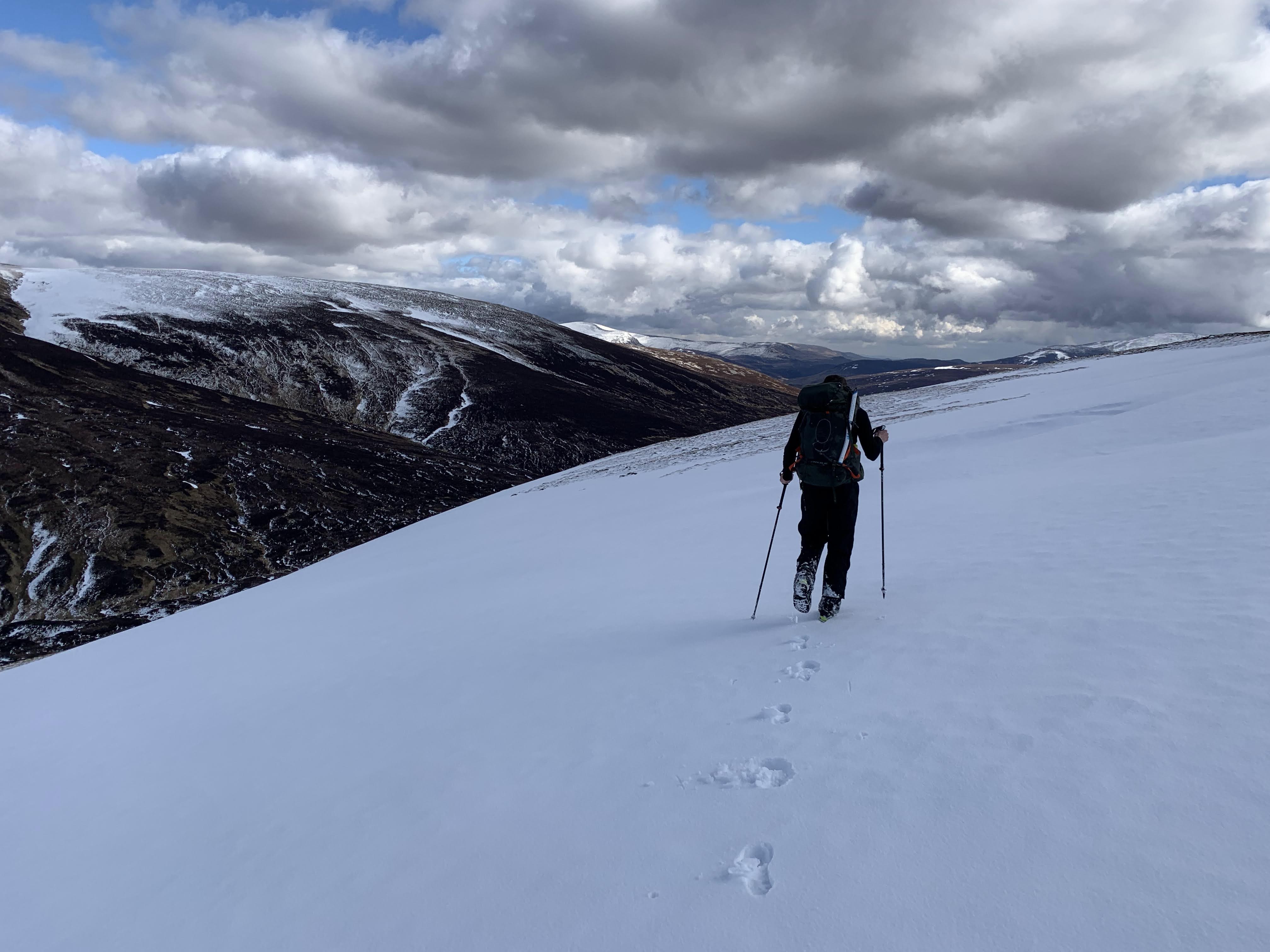
As I began the 12km approach to the base of Ben Alder, my anxiety worsened. I could see spindrift being blown at speed over the tops of Munros, and even at valley level, the gusts were causing significant buffeting. With each step, I became increasingly stressed, fearing every possible thing that could go wrong. I cut off from the path too early, desperate to start the climb, leaving me a longer than ideal heather bash to obtain the start of the slope I’d climb at NN 468 717.
As I looked up the broad mountainside, I saw spindrift being blown around violently, and yet again, my stress levels increased. I took a moment to rationally assess the situation; even though I was well within my comfort zone skill-wise – something about being alone was causing me anxiety. As I knew I was safe, and the concerns were psychological, rather than founded, I pushed on.
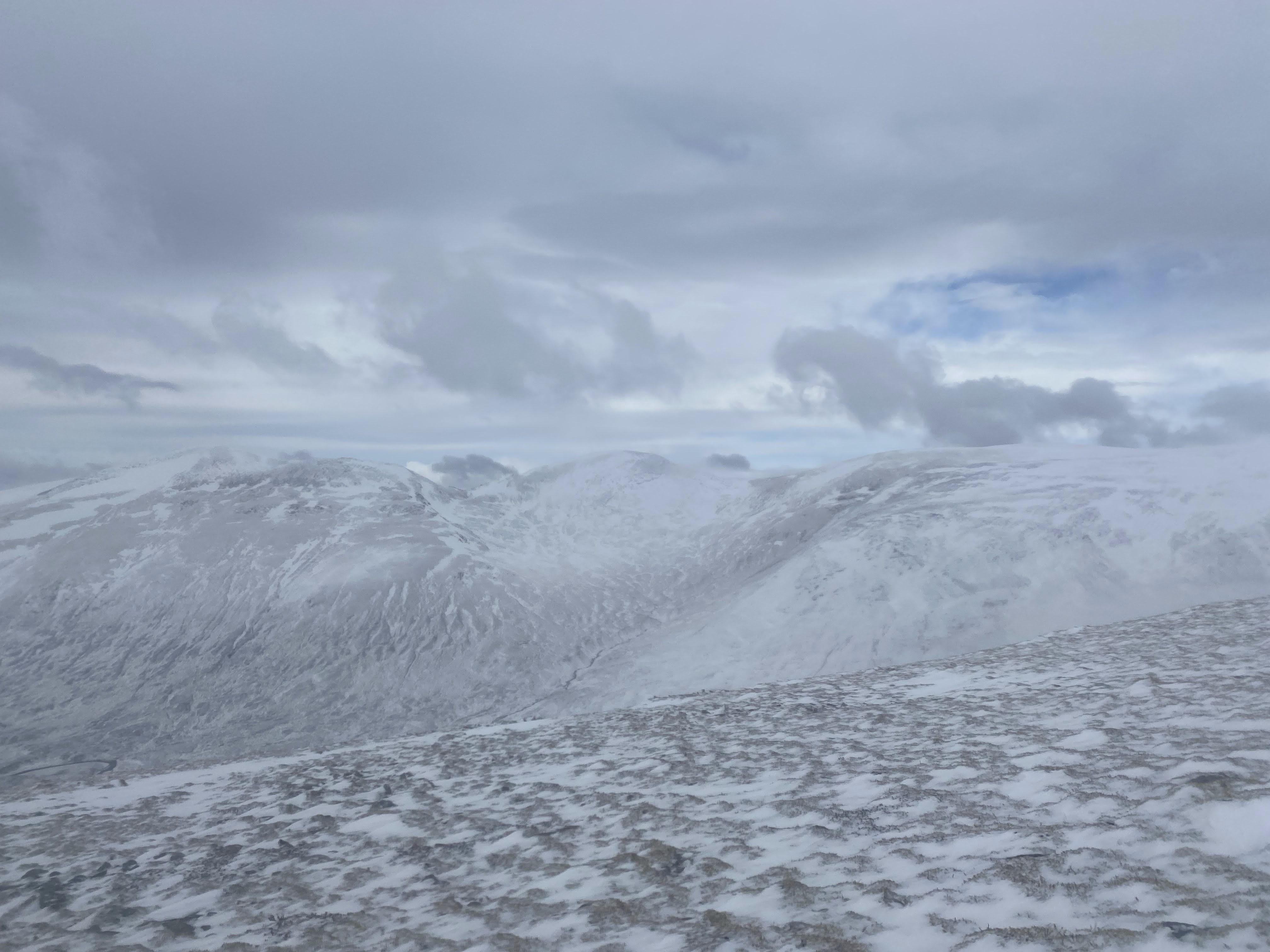
With each step up the broad slope, I began to feel more confident. As I looked back down at the river below, those lingering fears and worries began to shed. I reached the first band of spindrift, and it caused me no difficulties. The wind, whilst a hindrance, wasn’t above 40mph in the gusts, so didn’t impede mobility like I’d feared.
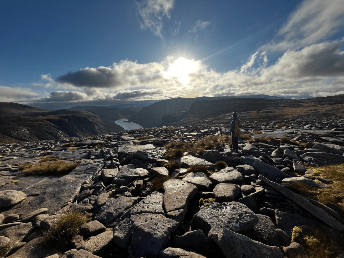
I reached the plateau – now in a mental state approaching euphoria. Somehow, looking out at the barren plateau, my worries and stresses had evaporated; I began to trust my skills. A quick nav check confirmed my direction, and I moved across this arctic environment to the summit, striding out on the consolidated snow like it was a London pavement.
The views behind were astonishing, the mountains were all covered in snow and the sun was shining from behind. Spindrift blew over each summit, highlighting the ridges and cliffs like a halo. Perhaps it was just the elation of achieving something that stressed me out, but as I moved towards that summit, it was one of the most special moments I’ve had in the mountains: totally isolated, without a phone signal, surrounded by stomach-churningly stunning mountains. I felt totally self-reliant – totally free and it was magical. I think I’ll remember those few special minutes for a long time…
The state of ecstasy from that magical 20 minutes on the summit plateau carried me back to the lodge, alongside a cheeky bit of karaoke; although we won’t talk any more of that. My friend met me at the start of the 4×4 track, liberating me from a lonely slog by the Lochside.
Closing Thoughts
Every trip I do to Scotland offers me something different. Some feel like an exercise in suffering, others feel like an escape. This trip felt like a change. It changed my mindset on what I can achieve, gave me confidence that I can manage longer days, and I can look after myself on the hill when alone. It made me realise how much I enjoy meeting new people, and how I’m perhaps less introverted than I initially thought. Most of all though, it gave me a much-needed break from the stresses of reality. Ace!
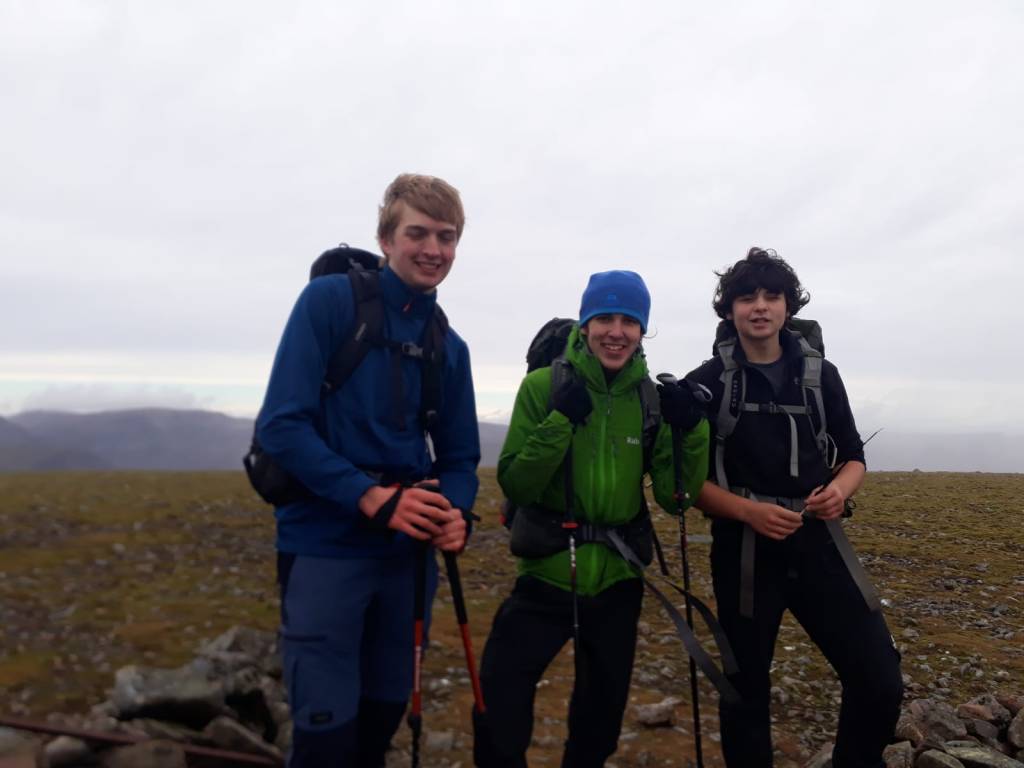
Most hillwalkers based in London cut their teeth for the first time in the Lake District or Snowdonia, becoming transfixed by the awe-inspiring views and rugged beauty of the environment; but neither place truly feels wild. The Scottish Highlands provide something different, a sense of grandeur and remoteness that causes that wonderful mix of trepidation, fear, and excitement before heading out into the hills. I’ve spent the last week up in Scotland with my Scout unit, for many, it was their first time in this environment. For all, it provided a memorable and unique adventure.
Day 1 – River Crossings and Bothy Nights
We awoke to the sound of heavy rain on the tent. The weather for that day was due to be abhorrent, with gusts of up to 80mph on the high tops and warnings for flooding on many rivers. This meant our original plan to journey into the Letterwe Forest and spend the night at Carnmore had to be scrapped – there would be too many river crossings on the walk in to make it a viable option. Despite this, John had a new idea up his sleeve: spend the morning relaxing and recovering from the 15 hour drive the previous day and then journey up to Coulags Bothy to spend the night. Following this, we would try and bag the Munro “Maol Chean-Dearg” the following day.
The morning was quite relaxed. We drove down to Lochcarron to pick up some firewood and coal for the bothy and then had lunch by the ruins of a castle. It was quite windy here and reinforced to us all that it was a sensible decision to avoid the high-tops today. After lunch, we drove to the layby where the walk into Corie Fionnaraich bothy begins from.
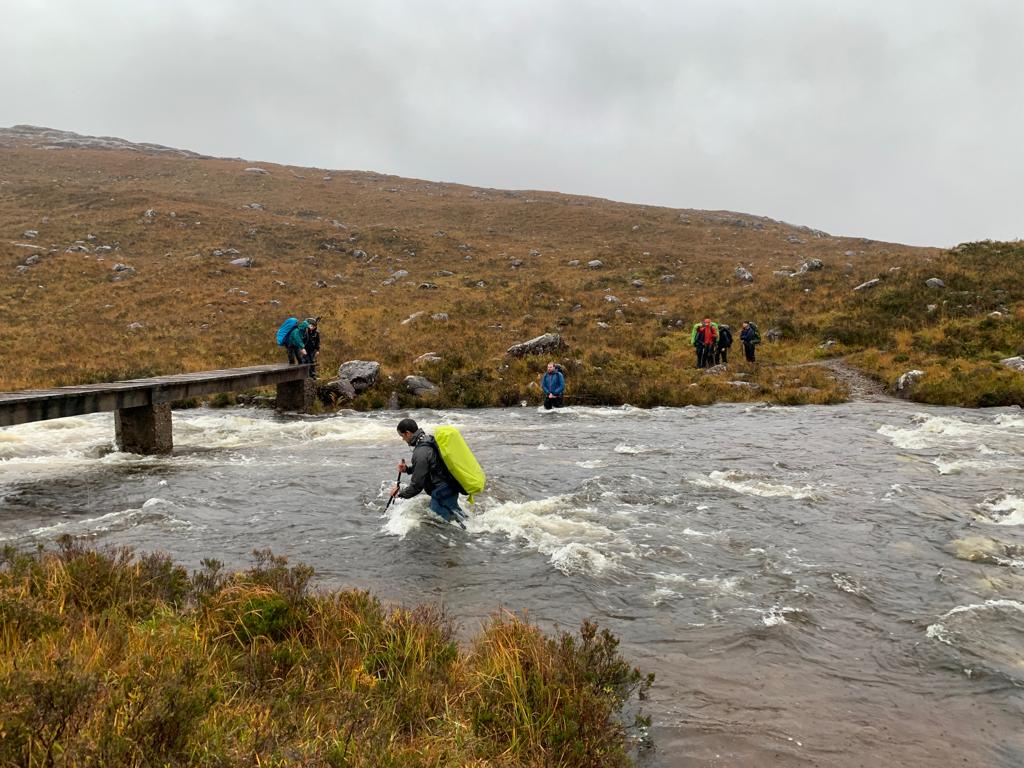
The walk-in is along a broad fire road for the start, with good bridges fording several small streams. The fire road then becomes a footpath, but it’s still incredibly clear and would be exceptionally difficult to miss. The footpath eventually lead to the side of the river, and a decision had to be made.
The bridge itself was old and rotten – it looked like it didn’t have much life left in it, and if it were to collapse under one of our weights, it would create a very dangerous situation. Initially, a river crossing seemed like the safer option; the river appeared shallow and the flow quite moderate. John briefed us on how to cross and myself, Mia, and Hugo began to work our way across. Immediately, the river was up to our knees – but it was manageable. I did make it quite a bit harder by angling us almost directly upstream – my hood was on so tight I couldn’t see where I was going. John swiftly informed me of my misdirection and I, a little embarrassed, angled the three of us straight across the river. The middle section wasn’t that deep, rarely getting above the knees. Before we reached the other side, a deep channel had to be crossed. This proved difficult – it reached the upper thighs and it was right at the limit of what I’d feel safe doing. Another leader of the trip, Nigel, managed to cross the river solo, a ridiculously impressive feat. From here, the decision was made to crawl across the bridge instead – the river would have proved too dangerous for the smallest members of the party.
The experience gained from this river crossing was invaluable. Not only had we learned the techniques to cross a river safely, but we had also seen a demonstration of the kind of continuous active risk mitigation we should all demonstrate in the hills. Personally, I would have barely looked twice at the bridge – potentially exposing myself to a very dangerous situation. This reminded me that it’s worth looking twice at even seemingly safe sections of a hike; there may be hazards that aren’t immediately obvious that could cause difficulty if ignored.
Upon arriving at the bothy, we enjoyed a relaxing evening. It was my first night in a bothy and I’m somewhat hooked – it was so cosy and comfortable inside, and it made for a great venue for late-night conversations with friends.
Day 2- A Tad Windy!
John had planned for us to loop around Maol Chean-Derag via Loch an Eoin, then assess the wind speed at the pass at NG 930 488 and make a decision about if to try and bag the Munro, the smaller peak, or neither. The initial loop was wonderful, the scenery was rugged and exciting and there was even a small river crossing to ensure that everyone’s boots were thoroughly soaked through! However, the second we headed around the Western side of Loch an Eoin, we were hit by a strong South-Westerly wind of around 25mph. This translates to enough to make your life difficult, but not enough to significantly reduce the speed at which you can progress. However, considering that we were low down and still had some shelter from the surrounding peaks, the prospects of heading up the Munro seemed increasingly unlikely.
After a brief lunch stop, we aimed for the saddle, a tailwind making the ascent significantly easier. Here, the call was made to attempt the Munro, and assess the wind speed on the way up. As we climbed, we made it about 20m vertically above the saddle when we reached the first small shoulder. Here, the wind was really quite strong. I wasn’t far from being lifted, and Joe’s glasses were blown off his face. To continue further would have been stupid, and the decision was made to head back to the pass and to try and get to the top of Meall nan Ceapairean, however, the strong South-Westerly was blowing us towards the cliffs on the Northern side of the mountain, so we swiftly scrapped this plan too and headed down to the bothy to repack and drift back down to the car.
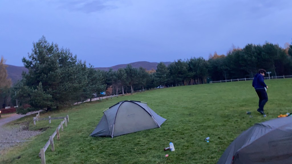
John managed to book us in at a campsite in Aviemore that evening, so we had a long drive through the stunning and remote scenery of the North West Highlands that evening, before a good rest at the campsite.
Day 3 – A Cheeky Bimble.
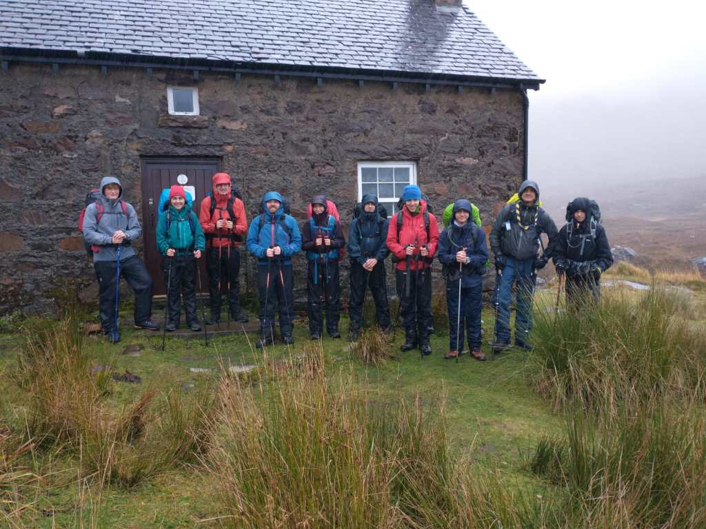
As we unzipped the tents in the morning, the weather looked clear and calm; a stark change from the gales and rain we had become accustomed to. This weather allowed a few of us to get out into the hills for a bigger day.
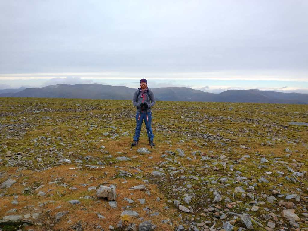
Whether looking hopeful – ready for a good day of hillwalking
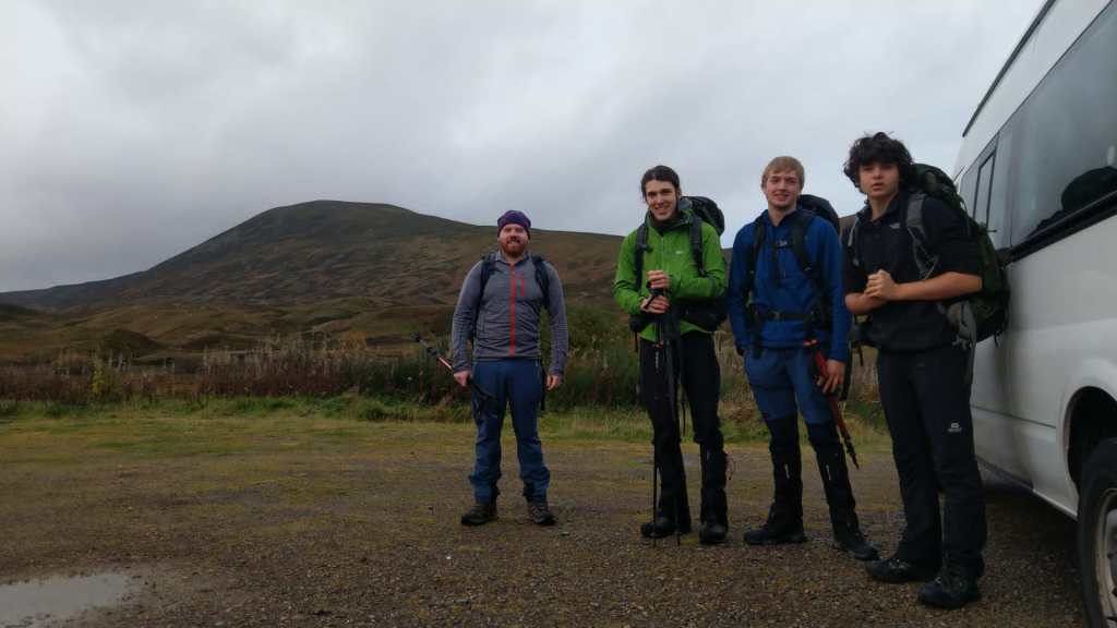
We piled into the minibus and drove for half an hour down the A9, aiming for a group of 4 Munros just off the Drumochter pass. They also gave a good viewpoint into the Ben Alder Forest – a large wilderness area containing many Munro’s and Corbetts.
Upon arriving at the Lay-by, we put the rucksacks on and started up the climb to Geal-Charn. The climb was simple, consisting of a 500m pull to a large plateau at 850m, then a much more gradual slope to reach the top at 917m. On the plateau, we were lucky enough to see some Ptarmigan, some ground-nesting birds that are common in the Eastern Highlands.
From here, we enjoyed a nice gradual descent down to a saddle, where we met a small lake where we took the opportunity to fill up with some water. Many high-level Munro rounds are notorious for having very few opportunities to re-fill along their course without a significant diversion, so any opportunities to refill should not be missed.
From the saddle, a path rose gently to the next Munro, the gradient being steep enough to warm us up after the brief water stop, but remaining far more comfortable than the eye-watering steep climbs that are the norm in the North West highlands. This leads to a broad ridge, with the summit of A’Mharconaich at 975m. From here, a gentle ridge led us along for around 4km to the summit of our third Munro, Beinn Udlamain at 1011m. The fog cleared as we were at the top, opening up a beautiful view into the Ben Alder Forest and across the rest of the Cairngorms
We headed down to the saddle between Beinn Udlamain and Sgairneach Mhor for a quick lunch. Wraps with chocolate spread were on the menu again – a delicious if not a nutritious bit of hill food. After lunch, we pushed up to the summit of Sgairneach Mhor. Sadly, it was misty at the top so we couldn’t see any of the surrounding hills!
We headed off the North-Eastern ridge and down into the valley, where we enjoyed a rather cheeky river crossing and great conversation along the fire road to the side of the A9.
Here, we yomped along the cycle lane, aiming to get back in the car park in good time so we could be picked up. A warm Youth Hostel and Fish and Chips awaited us…
Overall, it was a fantastic trip. A real chance to escape from the stresses and worries of everyday life and enjoy some remote-rugged scenery along the way!
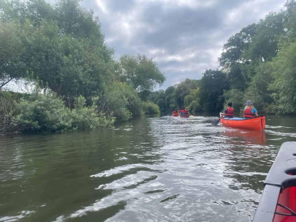
Travelling along a River is undoububly one of the most satisfying journeys one can complete. The simple, elequent joy of moving through different landscapes, from hills, mountains, and rapids nearer to the source, all the way down to locks and towns further downstream; it’s hard not to be amazed at how rapidly the character of the river, and it’s surroundings change. The River Severn is the longest river in the UK, and throughout it’s length, it traverses through stunning countryside on the Welsh border. Last week, our Duke of Edinbrugh Gold expedition involved travelling along the river, taking in it’s sights from Cilcewydd to Holt Lock.
Day 1 – 52.5km – A Crash Course in (Seriously) Long Distance Canoeing
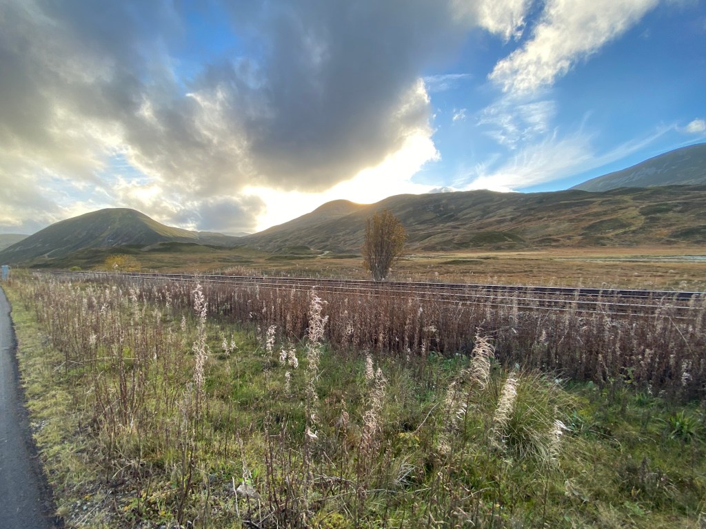
A stunning evening before the start of the expedition
To state the obvious, 50km is an awfully long way to paddle. For those of you who haven’t done much canoeing, you generally paddle at approximately walking pace. On a faster river, the speed may approach 6-7kph, and on a slow, flatwater river, it’s not unheard of to struggle to break 3kph in certain conditions. Despite the fact that the river was due to be fast flowing today – we knew there would be a fair few sections were we’d have to get out and walk due to the river being too shallow, and had been warned of a fallen tree blocking the river, requiring a portage around it. Given this, we opted for an early start – and aimed to be on the water for 6:30am.
Along a calm section…
Following this horrifically early start, we began our journey downstream. The river was immediately shallow, and we were already striking the ground with our paddles. What fun! There were occasional sections of grade 1 water, nothing noteworthy, but definitely enjoyable. One of these sections funnelled us towards a tree blocking the river, naturally, we didn’t see this until a little to late, so a very swift cross-deck bow-cut was required to wrench us from the rapid flow into an eddie to the right of the river where we could assess our options.
We pulled all the boats out of the water and noticed an oxbow lake (or something very near to an oxbow lake) to the right. A quick check of the map told us this would connect us to the river just downstream of the blockage. We had no choice but to portage round to the oxbow lake and try to paddle round. Despite this being slightly frustrating so early in the day, the portage was sucessful and we only lost about 20 minutes with all this faff.
Following this, the easy flat water, with intermitant grade one, continued till Welshpool weir. This is a very small weir which is too shallow to run, as we found out. We grounded out halfway and had to walk to the end of the weir – a little dissapointing, but once again, not a big time loss. (NB: We knew the weir would be safe to run and there was no stopper).
The river then proceeded along a narrow channel, with strainers constantly obstructing the path ahead and many sections of grade 1 water. This is a great example of low-risk, high(ish)-concequence paddling; although a capsize would be very unlikely, the strainers would seriously complicate it and would be a significant risk for a swimmer. We realised this a bit before lunch, when we very nearly got pinned beneath a low branch after chosing the wrong channel of the river to go down. We were lucky to be able to wiggle underneath (with difficutly), but if that strainer had extended all the way to the ground, we’d have been in a dangerous situation – and it would have required a fairly sketchy exit of the canoe and lining it back upstream to avoid the river.
The narrow, strainer lined paddling continued as the river began to turn East, towards the River Vyrnwy confluence. The river gradually got wider, and soon we were clear of the forested section (no more strainers!). There was a small weir which we ran (and grounded out on). It was here where we made the largest mistake of the day. The paddlers behind ran the weir before the others had cleared it, and almost caused a nasty accident as one boat narrowly missed my leg, and left me hanging on to the bow of the boat for dear life. What fun!
About 10km upstream of the River Vyrnwy Confluence
After the River Vyrnwy confluence, the character of the River changed significantly, back to the Severn that you are likely more familiar with. A wide channel of moderately fast water, with a handful of grade 1 sections along it’s course. We paddled on for about 16km after the River Vyrnwy confluence before hitting the campsite. This last paddle was brutal – we were all tired and morale was beginning to dip. Additionally, the dull nature of this paddling made us all the more aware of our sore arms. It was undoububly a relief to reach the campsite that evening at Montford Bridge.
The day took eleven and a half hours overall, and we only stopped for about twenty minutes during that time. This left my legs feeling cramped and left us all feeling a little broken for the next day. Two of our team decided that the expedition wasn’t right for them, so made the decision to head home. This left us feeling low, morale had to be boosted, otherwise the next three days would be extraordinarily tough.
Day 2 – 37km. Don’t trust the Cows.
A late start was called for. 7am alarms were set (please don’t remind me quite how outragous it is that that is considered a late start), but tired heads and low morale meant we weren’t on the water till 9:40. From here, the day began to get better and better. Good chat, and dreams of future expeditions in warmer countries (Italy here we come!) kept us going. The paddle was also somewhat interesting, with enough sections of moving water to keep the boredom at bay. Just before Shrewsbury we pulled onto a beach and had lunch.
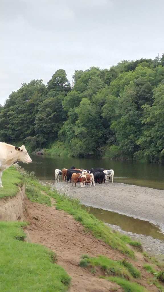
Our boats are in there…
They marched in before we could stop them; an army of cows swarmed our boats, taking them over and preventing us from approaching, especially as they had calves. We were naturally quite concerned – how the hell were we going to paddle the remaining 20km! We searched for the farmer, but only found a fairly exasperated local, who commented that they’re alright and we should approach the boats. They also said they had nothing to do with the cows, so we were a little reluctant to trust them. Luckily, the cows and dispersed enough to allow us to approach the boats in the water, and pull them straight out into the river, avoiding any more cow trouble.
The paddle through Shrewsbury was a little dull, at least until the weir. Sadly, the weir is pretty lethal, and shouldn’t be run, so a frustratingly long portage awaited us. Nevertheless, we got it done, and began our paddle down to Ismore coppice, where we stayed.
Sunny Paddling
That night, the morale was high. We’d just been told that due to a wake at the campsite the following night, we couldn’t arrive before 7pm, that meant a lie in, even by normal standards. What a treat! We (or rather the capable cooks) cooked up a delicious curry and we enjoyed a relaxed evening, chatting late into the night.
Day 3 – 33km – Oops.
After a long lie in, we left the campsite at 10:45 – ridicoulsly late for any expedition. The day started with a really enjoyable and relaxed paddle down towards Ironbridge. The river was mostly flat, but similar to the previous day, had enough sections of easy moving water to keep the interest level high.
That morning, I realised quite how lucky we were to be able to get an opportunity to paddle along the Severn. From a canoe, you develop a unique perspective on the world. These ancient waters have been providing for people for milenia, and as you journey along the river, you develop a unique appriciation of the historic significance of these water. This is still second do the nature that lines the side of the river, we saw a wealth of wildlife and were spotting Kingfishers multiple times per day. All whilst journeying though a wonderful corner of the UK.
We had lunch on a wonderful river bank and began discussing the main topic of the day, Jackfield Rapids. These rapids are a solid grade 2, well within our capabilities. Nevertheless, there was a risk of a capsize, so we took appropriate precautions to mitigate the risk of any wet kit should the worst happen.
As we approached the rapid, we briefly discussed our line of attack. On day 1, we had learned the importance of going one at a time, and communicating properly to each other. After a brief meeting, we concluded that Mia and I should run the rapid first, as we’d both done Jackfield previously, followed by Phoebe and Mimi, and finally Joe and Arno.
We all got down the rapids easily without any fuss, but were offered some additional whitewater training by our assessor to try and develop our skills further. This primarily involved ferry gliding across fast flowing water, moving up the raid, and eddying out. It concluded with a white-water swimming lesson- a key skill required to be safe following a capsize on a rapid.
After Jackfield, we proceeded down towards Bridgenorth. This section of river has a few easy grade 1 sections, but following Jackfield, we’d gotten a little bit negligent; after all, why would anything pose any challenges after that? Perhaps it was unsurprising then that we ran one of these sections two abreast, and Joe and Arno were forced into a branch (I promise our boat had nothing to do with it!) and they capsized. We quickly recovered (I promise those capsize drills are worth the effort), but two team members were left with wet kit, and one team member had almost no dry kit left. The barrels had completely failed to keep kit dry, and sadly, our team members were now paying the price.
As we continued down river, a sad mood fell upon us. For some reason, the capsize had a big affect on the morale of the group as a whole, leaving everyone feeling pretty low. This was made worse by the fact that by this point, it was about 7pm, and we were all getting hungry.
We finally pulled into the campsite at 7:30. To our surprise, the wake was still going on, but (with the permisson of the organisers) we wakecrashed, and began to load our boats into the field and setup tents. We cooked a quick dinner (pasta) and enjoyed some warm showers, but these did little to lighten the mood – it was a bit cold, we were quite damp, and extremely tired.
It’s these moments that are the most memorable in the expedition. For me, the discomfort, and low morale leaves you appriciating home comforts that little bit more at the end of the expedition. These lows also make the high points seem just that bit better, and they highlight quite how much of an emotional roller-coaster a trip can be.
That night, we made the difficult decision to wake up at 5:30am the following day for an early departure…
Day 4 – 37km – The Home Straight
After yesterday’s events, no one was expecting an enoyable last day, but somehow, the team pulled together. We got going swiftly in the morning, and made fast progress down the river, undoububly aided by the fast moving current. We enjoyed a few brief sections of moving water, and basked in the sunlight.
A relaxed lunch break on a beach (underneath an A-road bridge) marked the end of the interesting paddling. Soon after this, we hit Stourport-On-Severn, and began to see all the big boats and tourists. It’s always a surreal experience to go back into civilisation after an expedition; not only do you have a ridiculous amount of kit, you also haven’t really seen all that many people for the last few days, and it’s a little overwhelming to suddenly be back in a big town, with big bots and locks.
After a few short locks, and a painfully boring paddle along a flatwater section, we finished the expedition, enjoying the sun and laughing.
Closing Thoughts
Like all worthwhile journeys, the trip had it’s highs and lows. There were moments where we all felt sore, miserable, and exhausted, but these were outnumbered by the hours of enjoyable paddling on the river. We really got to know the Severn, from it’s narrow and fast start, to it’s slower and wider lower course, all the whilst enjoying stunning countryside.
The Carneddau mountains of Snowdonia are truly special. They seem slightly different from the rest of Snowdonia, perhaps it is the fact that once up on the plateau, you rarely drop below 800m, or that it feels much quieter and more remote than other parts of Snowdonia. Whatever it is, it has always been my favourite part of the national park; so naturally, a longer backpacking rotue traversing the range was something that had to be on the agenda.
Day 1
We started the day at Platt’s Farm campsite in Llanfairfechan. From here, we walked on a large track up towards Drum. Unforchenately, the visibility was non-existant so we missed out on some of the views.
From Drum we continued to traverse across to Foel Fras.
Approaching the summit of Foel Fras
We decided it was a little to early to eat lunch, so pushed on to Carnedd Gwenllian for lunch.
Starting to get a little bit of visbility
After pushing on to Foel Grach, we moved on to Carnedd Llewelyn and then across to Carnedd Dafydd. At long last, the visbility began to increase and we enjoyed a stunning cloud inversion.
At this point, we were hoping to camp near the summit of Carnedd Llewelyn, but we couldn’t find any water. We did sight out a small pond near the top of Foel Grach, but it was extremely grim and we agreed it was not safe to drink from, even with a filter. So, reluctantly, we dropped down to Ffynnon Lyffant to pitch up.
The pitch. The tent is just visible…
Day 2
The day started with a ridiculously steep pull out of the Cwm.
Silly Steep – not fun on tired legs
From here, we climbed to Foel Grach, and then along to Foel Fras.
We decided to drop down to Llyn Anafon and take the track back down to Llanfairfechan. This turned out to be surprisingly stunning!
Final Thoughts
I loved this route. It is undoububly one of my favourite backpacking routes, and I have no doubt I’ll repeat it in the future. It does have to be said, the distances and elevation gain involved are significant – with about 1600m of climbing on the first day, and 500m on the second, good fitness and confidence over mountain terrain are required. Much of the route is on a plateau too, which in low visibility can be difficult to navigate on.
Nevertheless, anyone who is comfortable moving in the mountains should try this route. For me, it is an ode to a range that is often forgotten about. Crowds are drawn to the rocky structures of the Glyderau, and the fame of the Snowdon range, but for those that like their hills big, remote, and with a splash of wilderness, the Northern Carneddau are difficult to beat.
This post is about a Windemere to Penrith traverse, crossing over high-street and bagging 16 fells along the way.
The trip started with an outragously early start of 5am, before catching a train from Euston all the way up to Windemere train station. The excitement was palpable – this was my first time back in the fells for almost a year and I was desperate to get moving. After an hours wait, I met a friend, who had travelled up from Wales, and after distrubuting the group kit, and having a quick lunch, we set off into the fells.
The start of the route consisted of 5km or so of low farmland, before joining the Garburn road (not actually a road, but a wide track). This took us up onto the ridge, where we’d stay for the next two days. I have to admit, this was one of the less enjoyable parts of the walk, the weather was really closing in and the visibility was non-existant, somewhat deducting from the enjoyment of the walking.
Upon reaching the ridge, we quickly diverted up Swallows, before continuing along the ridge to Yoke. Here, we dropped down to Rainsborrow Crag to pitch up.
The weather was evidently not ideal, so we got into the tent and got a few hours kip: neither of us had had more than three hours of sleep the night before, so it was fair to say we were absolutely exhausted.
“Wake up”, I whispered my friend at around 6:30pm. I unzipped the tent and looked outside to see a stunning vista. We had pitched above a large crag, so we knew the views would be good, but we were both amazed at quite how stunning it truly was.
The views drew us up to the top of III Bell, where we enjoyed a stunning sunset.
Once we arrived back at the tent, we settled down and enjoyed a good nights rest.
We started early the next morning. The day was a big one, about 30km with 1500m of climbing (an awful lot with heavy expedition bags). We left camp at around 8:30 and set off walking.
The route took us up towards Thornthwaite Beacon, then down towards Harter Fell.
From Harter Fell, we headed up and over High Street.
From High Street, we headed across to Rest Dodd, then down to Angle Tarn.
From Angle Tarn, we traversed back up to High Raise, then dropped down to Red Crag tarn to spend the night.
Here, we spend an enjoyable night, and enjoyed a glorious sunset.
The next morning, we woke up knowing that it would be our last day on the hill. It always makes the heart sting knowing that by this evening, we’d be back in the big smoke. Especially when you wake up to views like this.
At first we walked up to Loadpot Hill, before traversing down to Stockbridge and across to Penrith. This was not a particularly nice route, especially after we got down from Loadpot hill and left the Lake District behind.
We arrived at Penrith exhausted. We’d covered 60km with about 3000m of climbing (with 1500m of that on day 2!). Fish and chips managed to pick us up a little, before we caught the train home.
Closing Thoughts
This was one of the most enjoyable backpacking routes I’ve done. We managed to avoid the crowds during a busy week in the Lake District, and avoid roads and civillisation for two days. I have now doubt I will repeat this route, and I would recommend it to anyone looking to do a backpacking route in the Lake District.